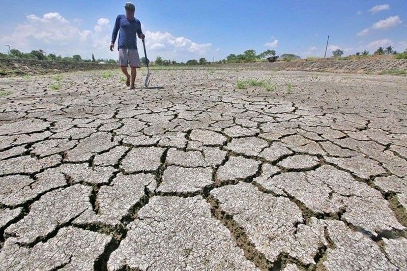
El Nino arrives, raising extreme weather fears

WASHINGTON, United States — An expected El Nino climate phenomenon has arrived, raising fears of extreme weather and temperature records, scientists at the US National Oceanic and Atmospheric Administration said Thursday.
Marked by warmer-than-average sea surface temperatures in the central and eastern Pacific Ocean near the equator, the weather pattern last occurred in 2018-19, and takes place every 2-7 years on average.
"Depending on its strength, El Nino can cause a range of impacts, such as increasing the risk of heavy rainfall and droughts in certain locations around the world," said NOAA climate scientist Michelle L'Heureux.
"Climate change can exacerbate or mitigate certain impacts related to El Nino. For example, El Nino could lead to new records for temperatures, particularly in areas that already experience above-average temperatures during El Nino," she added.
Australia this week warned El Nino would deliver warmer, drier days to a country vulnerable to fierce bushfires, while Japan said a developing El Nino was partly responsible for its warmest spring on record.
Most of the warmest years on record have occurred during El Ninos, and scientists are concerned that this summer and next could see record temperatures on land and in the sea.
Mariana Paoli of relief agency Christian Aid said: "Poor people are already being pushed to the brink through droughts, floods and storms caused by the burning of fossil fuels and now they will be facing the supercharged temperatures of the El Nino effect.
"These people are the worst affected by climate change but have done the least to cause it."
Suppressive effect on Atlantic hurricanes
The phenomenon's influence on the United States is weak during summer but more pronounced starting from late fall through spring, NOAA said in its statement.
By winter, it is estimated there is an 84 percent chance of a "greater than moderate" El Nino developing, and a 56 percent chance of a strong El Nino.
This in turn would typically cause wetter than average conditions in some parts of the country, from southern California to the Gulf Coast, but drier than average conditions in the Pacific Northwest and Ohio Valley.
It also raises chances for warmer-than-average temperatures in northern parts of the country.
Developing El Nino conditions were already factored into NOAA's hurricane predictions last month.
It has a suppressive effect on hurricane activity in the Atlantic, but typically boosts hurricane activity in the central and eastern Pacific.
El Nino, meaning "Little Boy" in Spanish, is the warm phase of the El Nino–Southern Oscillation.
La Nina, meaning "Little Girl," is its colder counterpart, where sea surface temperatures in the eastern and central Pacific Ocean near the equator are lower than normal.
- Latest
- Trending


