LPA outside PAR develops into tropical depression — PAGASA

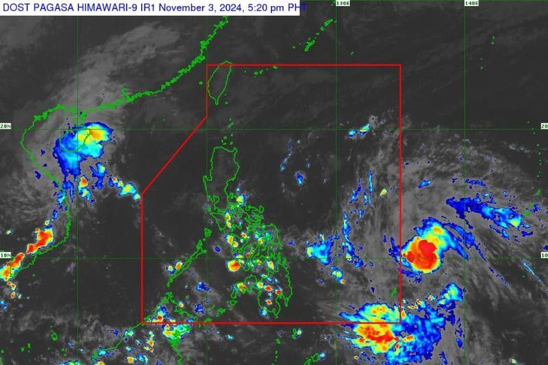
MANILA, Philippines — The low-pressure area outside the Philippine area of responsibility (PAR) has developed into a tropical depression and is expected to enter PAR by Monday, November 4, state weather bureau PAGASA said.
As of 5 p.m., PAGASA estimated the tropical depression at 1,315 kilometers (km) east of Eastern Visayas. It packs maximum sustained winds of 55 kilometers per hour (kph) near the center and gustiness reaching up to 70 kph.
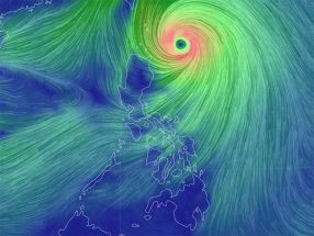
It is moving northwestward at a speed of 30 kph generating strong winds extending up to 340 km from its center.
Once inside the PAR, it will be named tropical cyclone “Marce,” according to the state weather bureau.
Forecast and movement
The tropical depression is anticipated to move rapidly northwestward and enter PAR on Monday.
It will continue on its northwest trajectory until Tuesday, November 5, after which it is expected to slow down and shift northward.
By midweek, the tropical depression is expected to move slower, drifting northward and potentially westward near extreme Northern Luzon.
PAGASA said there are two possible scenarios for its path beyond midweek: Either it will move closer to extreme Northern Luzon and potentially mainland Luzon, or it will display erratic movement over the Philippine Sea east of Northern Luzon.
Due to this uncertainty, the state weather bureau said that the forecast track may change in subsequent advisories.
Impacts on weather
As the weather system advances into PAR, PAGASA said that the tropical depression is expected to intensify the northeasterly wind flow, which could bring rain to extreme Northern Luzon and eastern Luzon starting late Sunday or Monday.
If the cyclone takes a more westward path, direct impacts from heavy to torrential rainfall could be experienced in Northern Luzon by Thursday, November 7, or Friday, November 8.
This poses the risk of flooding and rain-induced landslides, particularly in areas with saturated soil from previous rains, according to the state weather bureau.
Marine Conditions
Moderate to rough seas are already affecting the seaboards of Northern Luzon due to northeasterly winds, and these conditions are expected to worsen as the tropical depression intensifies this flow.
These conditions will impact the seaboards of Northern Luzon, as well as the western and eastern seaboards of Central and Southern Luzon, throughout the week.
PAGASA also said that it may issue a gale warning for Northern Luzon’s seaboards as early as Tuesday.
- Latest
- Trending


