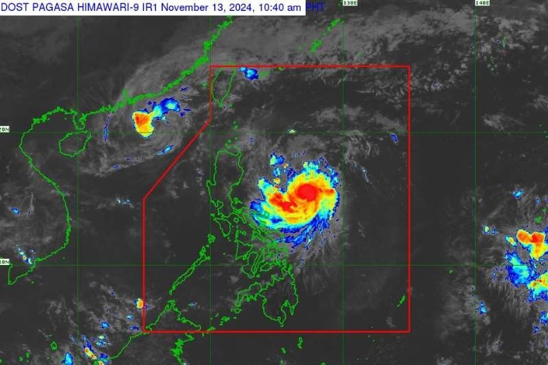
‘Ofel’ maintains strength; Signal No. 1 and 2 raised over parts of Luzon

MANILA, Philippines — Typhoon “Ofel” (international name: Usagi) has maintained its strength as it continued moving west-northwestward over the Philippine Sea, posing a threat to some parts of Luzon, state weather bureau Pagasa said.
In Pagasa's 11 a.m. advisory on Wednesday, November 13, was estimated at 485 kilometers (km) east northeast of Daet, Camarines Norte, or 610 km east of Infanta, Quezon.
The typhoon is moving west northwestward at 20 kilometers per hour (kph) with maximum sustained winds of 120 kph and gusts of up to 150 kph.
Tropical cyclone wind signal
Pagasa has raised Tropical Cyclone Wind Signal No. 2 in the following areas:
The eastern portion of mainland Cagayan:
- Baggao
- Peñablanca
- Gattaran
- Gonzaga
- Lal-Lo
- Santa Ana
The eastern portion of Isabela:
- Maconacon
- Divilacan
- Palanan
For areas under TCWS No. 2, wind speeds range from 62 to 88 kilometers per hour (, posing a minor to moderate threat to life and property.
Meanwhile, the state weather bureau placed the following areas under Signal No. 1 in the following areas:
- Batanes
- Babuyan Islands
- The rest of mainland Cagayan
- The rest of Isabela
- Quirino
- Nueva Vizcaya
- Apayao
- Kalinga
- Abra
- Mountain Province
- The eastern portion of Ifugao: Dilasag, Casiguran
- Ilocos Norte
- The northern portion of Aurora: Alfonso Lista, Aguinaldo, Banaue, Mayoyao, Hingyon, Hungduan
The wind speeds range from 39 to 61 kph, with potential impacts that may include a minimal to minor threat to life and property.
Coastal hazards
Pagasa also issued storm surge warnings, with waves of 1.0 to 3.0 meters possible over Batanes, Ilocos Norte, Ilocos Sur, Cagayan, Babuyan Islands, Isabela, and northern Aurora in the next 48 hours.
Sea travel remains risky, with very rough seas expected along several coastal areas. Mariners and residents in affected areas are urged by the state weather bureau to remain vigilant.
Forecast track and intensity
Ofel is expected to intensify further and may reach peak intensity before making landfall along the eastern coast of Cagayan or Isabela on Thursday afternoon.
It will then cross the Luzon Strait by Friday, November 15, potentially taking an erratic path during the weekend.
Authorities stress that hazards such as heavy rainfall, flooding and storm surges may still occur outside the forecast confidence cone.
- Latest
- Trending


