Enhanced
The weather scientists are hurting.
They do issue timely warnings about approaching tropical cyclones and the monsoons, and they do get it right, according to the forecasters of the Philippine Atmospheric, Geophysical and Astronomical Services Administration (PAGASA).
So why do people, including certain government officials, think otherwise?
Even President Marcos seems to believe the warnings are given too late. He has ordered relevant agencies to improve the system so that classes and office work can be suspended and disaster mitigation preparations can be done on the eve of the projected arrival of heavy monsoon-induced rainfall or a powerful cyclone.
The problem may lie in the way we get our weather warnings, which is mainly through our cell phones. These are the noisy alerts sent out by the National Disaster Risk Reduction and Management Council (NDRRMC), providing color-coded rainfall advisories with warnings about possible flooding and landslides.
At least this is what I and most of the people I know remember about the way we learn about weather warnings.
PAGASA personnel point out (correctly, it seems) that they have people on duty 24/7, and that they release weather warnings around the clock to the public.
The problem probably lies in the way people access such warnings. Who goes out of his way to check out the PAGASA website regularly? Why, people don’t have enough time even to watch everything they like on TikTok and monitor their social media exchanges.
Not everyone watches or listens to the evening news, where PAGASA weather advisories are reported. When it comes to the weather situation, we’re mostly passive folks; we prefer to wait for the government to send us the warning when needed, through the most convenient way – cell phone alerts.
The NDRRMC does this for rainfall warnings, presumably based on the PAGASA advisories. The problem is that we get the NDRRMC alerts in real time, when we are already stuck in flooded streets, or looking out the office or school window at the downpour that has caused near-zero-visibility, with floodwaters rising rapidly all around us.
* * *
This was what I encountered last Sunday night, as Enteng was elevated by PAGASA from a low-pressure area to a storm. Driving home from work, I could barely see the road in the pounding rain, as my cell phone rang out with the NDRRMC rainfall warning alert.
The next day, after a night of heavy rainfall, classes and work in government offices were suspended belatedly. Throughout the day, we received the real-time rainfall, flood and landslide alerts on our cell phones.
Maybe the NDRRMC considers it a good idea to provide rainfall and flood warnings in real time. But being an agency in charge of disaster risk reduction, shouldn’t it be concerned with preparedness, which calls for early warnings?
Either the NDRRMC improves its coordination with PAGASA to provide early warnings, or the council turns over the task of providing the cell phone alerts to the weather bureau.
PAGASA is under the Department of Science and Technology. The NDRRMC is under the Office of Civil Defense, which is under the Department of National Defense. It seems like the left hand doesn’t know what the right hand is doing.
Weather scientists may have to tweak their storm warning system. Local government and school authorities base class suspension announcements on this warning system.
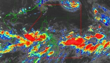
The storm alerts, however, are based on peak wind speed, as can be gleaned from the name given by PAGASA to what used to be known as “typhoon signal”: Tropical Cyclone Wind Signal. This is why there was no “typhoon signal” over Metro Manila as Typhoon Carina passed through the country last July, and as Storm Enteng entered Luzon and the Visayas.
In fact the advisory was that Carina would not even make landfall in the country. PAGASA did warn that the southwest monsoon or habagat, characterized by heavy rainfall and humid weather, would “enhance” Carina, which intensified into a super typhoon as it left the Philippine area of responsibility.
A similar monsoon “enhancement” warning was issued for Enteng.
Enhancement is normally associated with a positive improvement. How about changing “enhance” to “worsen”? Or aggravate? Exacerbate? Compound? Heighten or strengthen? Mr. Google has an extensive thesaurus.
The warning should be simpler in Filipino: magpapalala ng epekto ng bagyo.
* * *
I was out of the country when Ondoy struck in late September 2009, but I think the same problem with storm warnings and monsoon enhancements resulted in the catastrophic consequences of that storm, which later intensified into a typhoon. Ondoy turned out to be the second most destructive tropical cyclone in the Pacific during the 2009 typhoon season.
We should have learned our lessons from Ondoy. Obviously, we didn’t.
Only weather scientists in this country probably understand the possible catastrophic consequences of monsoon “enhancement” of a tropical cyclone. Those implications are not properly communicated to the public, and especially to the government agencies and officials in charge of disaster preparedness, response and mitigation.
PAGASA may have to reword its warnings to emphasize the risks posed by a monsoon-enhanced cyclone with wind speed that does not merit even a Signal No. 1.
The DOST and DND should then discuss which agency is better suited to deliver those storm warning alerts on our cell phones.
Disaster preparedness starts with a reliable warning, communicated and disseminated efficiently. The existing warning system can use enhancement.


- Latest