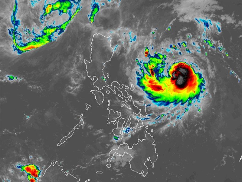
'Ofel' now a typhoon

MANILA, Philippines — Tropical cyclone Ofel (international name: Usagi) further intensified into a typhoon as six areas in northern Luzon are placed under Signal No. 1 on early Wednesday.
In its 5 a.m. weather bulletin, state weather bureau PAGASA reported that Ofel was spotted 475 kilometers east-northeast of Virac, Catanduanes or 595 kilometers east of Daet, Camarines Norte.
The typhoon is bearing peak winds of 120 kilometers per hour near its center, with gusts reaching 150 kph.
It is moving westward at a speed of 25 kph, with typhoon-force winds extending up to 300 kilometers from its center.
Wind signal
PAGASA raised Tropical Cyclone Wind Signal No. 1 over the following areas:
- Cagayan including Babuyan Islands
- northern and central portions of Isabela (Maconacon, San Pablo, Cabagan, Santa Maria, Divilacan, Palanan, Santo Tomas, Alicia, San Mateo, Aurora, Quezon, San Mariano, Naguilian, Dinapigue, Roxas, San Guillermo, Luna, Delfin Albano, City of Cauayan, Ilagan City, Angadanan, Benito Soliven, Tumauini, Reina Mercedes, San Manuel, Cabatuan, Quirino, Gamu, Mallig, Burgos)
- Apayao
- eastern portion of Kalinga (Rizal, City of Tabuk, Pinukpuk)
- easternmost portion of Mountain Province (Paracelis), and the easternmost portion of Ifugao (Alfonso Lista)
Winds between 39 and 61 kph may be expected in at least 36 hours or intermittent rains may be expected within 36 hours. Minimal to minor impacts from strong winds are anticipated.
Heavy rains, severe winds
Ofel is expected to bring significant rainfall that could trigger flash floods and landslides in areas affected.
According to PAGASA, the highest wind signal that may be raised is Signal No. 4.
Strong to gale-force winds are expected in the following areas:
- Wednesday, November 13: Camarines Norte, Camarines Sur and Catanduanes
- Thursday, November 14: Camarines Norte and the eastern portion of Quezon including Polillo Islands
- Friday, November 5: Eastern portion of Isabela
Storm surge, sea conditions
Coastal areas in Batanes, Ilocos Norte, Ilocos Sur, Cagayan, Isabela and northern Aurora face a heightened risk of storm surges up to 3 meters high over the next 48 hours.
PAGASA said sea travel is dangerous for small boats, including motorbancas. Mariners are advised to exercise caution as rough seas, with wave heights of up to 3.5 meters, are expected along the northern and eastern seaboards of Catanduanes.
Moderate seas are expected across the eastern coastlines of Cagayan, Isabela, Aurora, Quezon, Albay, Sorsogon, Camarines Norte, Camarines Sur and Northern Samar, with wave heights reaching up to 2.5 meters.
Track, intensity outlook
The state weather bureau said Ofel will continue its west-northwestward trajectory across the Philippine Sea, with a potential landfall along the eastern coast of Cagayan or Isabela by Thursday afternoon or evening November 14. The typhoon may strengthen further as it nears landfall.
Ofel is expected to traverse the Luzon Strait on Friday, November 15, shifting to a more north-northwestward path while gradually slowing down and exhibiting erratic movements over the weekend.
PAGASA said that Typhoon Ofel’s path could still change, particularly in the days ahead. It may either shift slightly southward or curve to the northeast, keeping much of northern Luzon in its direct path.
- Latest
- Trending


