Dredging of Marikina River starts Wednesday

MANILA, Philippines — The dredging activities in Marikina River will start on Wednesday as the Department of Environment and Natural Resources found out that 25 lot parcels, with a total area of 27 hectares, were illegally reclaimed, DENR Secretary Roy Cimatu said over the weekend.
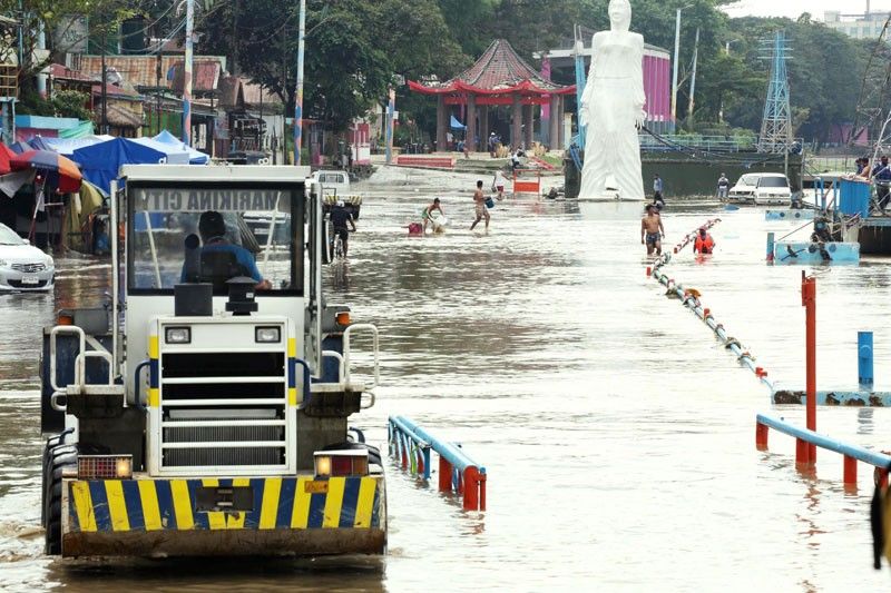
Cimatu said the Task Force Build Back Better, which was created after massive flooding struck Marikina and other cities in Metro Manila in November last year, would lead the dredging.
“Using official land records dating back as far as 1914 and 1961, historical maps and satellite photos from the National Mapping and Resource Information Authority as basis, the DENR National Capital Region conducted aerial and ground verification surveys that confirmed encroachments not only in the river but in the designated legal easements as well,” Cimatu said.
The pilot dredging operation will be held in the portion of the river near Marcos Highway in Barangay Kalumpang with a simultaneous bamboo planting in Barangay Industrial Valley Complex.
Based on a recent land survey, the DENR said a total area of 271,625 square meters were reclaimed without the necessary permits, either partially or completely encroaching into the Marikina River.
The DENR said this was in violation of Section 51 of Presidential Decree 1067 or the Philippine Water Code, which prohibits the construction of any permanent structure within three meters of the banks of rivers and lakes in urban areas, as these areas are reserved “for public use.”
Eight of the lot parcels covering 12,039 square meters were found to have been reclaimed but with no titles nor claimants, according to the DENR.
Five titled lots were found partially encroaching on 10,418 square meters of the river while 16 titled properties, measuring 22,467 square meters, were constructed in the river itself.
“We will have to show our political will here and sustain our efforts to rehabilitate Marikina River and other waterways,” Cimatu said.
He said the task force would also dredge the downstream portion of the Marikina River, particularly in the Pasig area where the riverbank is narrower due to the reclamations and presence of illegal structures.
Cimatu said with the width of 90 meters in the upstream portion, the Marikina River has become narrower in the downstream portion, with the Marikina-Pasig boundary having a width of 80 meters.
DENR records also showed that Marikina River’s depth has considerably dropped.
Cimatu said from eight meters in the upstream portion, the river’s depth was down to three to five meters in the Pasig area.
He said the restored riverbanks would be planted with bamboo to help prevent soil erosion and siltation.
- Latest
- Trending


