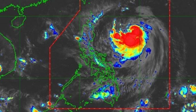
MANILA, Philippines — Tropical depression Onyok intensified into a storm shortly after it entered the Philippine area of responsibility yesterday.
Onyok entered the country at around 2 a.m. and intensified into a storm before noon, the Philippine Atmospheric, Geophysical and Astronomical Services Administration (PAGASA) said.
Tropical cyclone wind signal No. 1 was raised over Batanes and Babuyan islands at 5 p.m. yesterday.
PAGASA said the trough or extension of the storm would bring scattered light to moderate rains and thunderstorms over Bicol and Eastern Visayas.
Residents were advised to brace for flash floods and landslides.
Fishermen were warned not to venture out in the sea in Batanes and Babuyan.
As of 4 p.m. yesterday, the center of Onyok was estimated 890 kilometers east of Tuguegarao City, Cagayan, packing winds of 75 kms per hour near the center and gustiness of up to 90 kph. It was forecast to move west-northwest at 35 kph.
PAGASA said Onyok might intensify into a severe tropical storm within the next 24 hours, but is “less likely” to hit landmass.
Onyok is the 15th tropical cyclone to enter the country this year and fifth this month.
The state weather bureau said up to six tropical cyclones might hit the country before the end of the year. It said two or three cyclones might enter next month, one or two in November and at least one in December.


