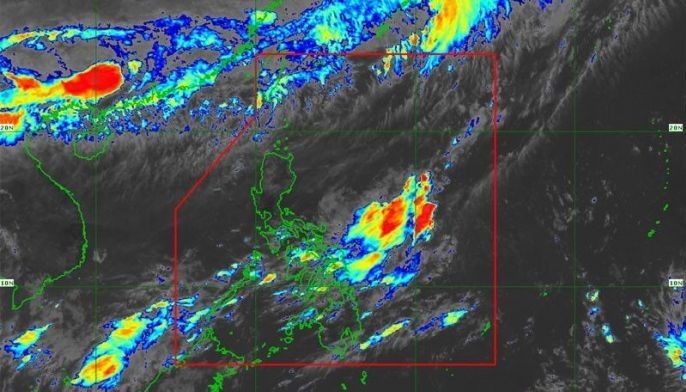
PAGASA says the LPA may develop into a tropical depression within 48 hours. Read the latest update on the LPA here.
MANILA, Philippines— The low pressure area being monitored by the state weather bureau entered the Philippine Area of Responsibility on Saturday.
PAGASA weather specialist Gener Quitlong said the LPA entered PAR at 7 p.m. on Saturday.
At 3 a.m., the LPA was located 890 kilometers east northeast Guiuan, Eastern Samar.
“So far, it has no effect in the country yet,” Quitlong said in Filipino during the early Sunday weather forecast.
According to Quitlong, the LPA’s extension, or trough or outer cloud band will affect Visayas and Mindanao.
Despite this, PAGASA said the LPA is not seen to intensify into a tropical depression in the next few hours. However, Quitlong said there is a possibility that it will develop into a tropical depression after two or three days.
It will then be named “Dodong.”
On Sunday, the whole of Mindanao and Eastern Visayas is projected to experience cloudy skies with scattered rainshowers and thunderstorms while Western and central Visayas will have partly cloudy to cloudy skies with localized thunderstorms.
Meanwhile, Quitlong said Luzon, including Metro Manila, will experience fair weather.
He also warned of isolated rainshowers in the afternoon or evening brought by localized thunderstorms.
On Wednesday, Metro Manila may have cloudy skies with scattered rainshowers.
Metro Manila is also projected to experience 33 to 34 degree Celsius temperature in the next three days. —Rosette Adel


