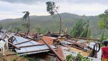
'Mario' makes landfall over Cagayan
MANILA, Philippines - Tropical Storm "Mario" made landfall over the northern tip of Cagayan before Friday noon, the Philippine Atmospheric, Geophysical and Astronomical Services Administration (PAGASA) said.
In its weather bulletin issued at 11 a.m., PAGASA said the center of the tropical storm was located at 64 kilometers north northeast of Tuguegarao City.
Mario has maintained its strength with maximum sustained winds of 85 kilometers per hour near the center and gusts of up to 100 kph.
The storm was forecast to move west northwest at 22 kph. By Saturday morning, it will be at 190 kilometers northwest of Itbayat, Batanes.
It is expected to be outside of the Philippine Area of Responsibility by Sunday morning.
Public storm warning signals are still hoisted over the following areas:
Signal No. 2
Cagayan
Calayan Group of Islands
Babuyan Group of Islands
Batanes Group of Islands
Isabela
Kalinga
Apayao
Mt. Province
Abra
Ilocos Norte
Batanes Group of Islands
Signal No. 1
Aurora
Quirino
Nueva Vizcaya
Ifugao
Benguet
Ilocos Sur
La Union
Residents in low lying and mountainous areas under the storm signals are alerted against possible flashfloods and landslides, PAGASA said.
Moderate to intense rainfall amount (7 to 20 millimeters per hour) have been estimated within the 350-kilometer diameter of the tropical storm.
PAGASA said the combined effect of Mario and the southwest monsoon or "habagat" will bring moderate to heavy rains and thunderstorms in Metro Manila and the rest of Luzon which may trigger flashfloods and landslides.
Incessant rains in Metro Manila caused flooding in several areas in the Metro, prompting government to suspend classes and work in public offices.
- Latest
- Trending


