Olaf & me over 1,415 kilometers
Five years ago, I did a memorable 22-day, 41-province backpacking trip around the country. That led me to set my next goal: driving the length and breadth of the archipelago. That dream from five years ago was realized – even if only partially – during the recent Holy Week.
MANILA, Philippines — At 5:30 a.m. of Holy Tuesday, with my mother Flor and my five-year-old nephew Matty in tow, I found myself starting up Olaf – our car was named by Matty after his favorite character from the movie “Frozen” – and heading north from our home in Angono. The odometer reading was 31,761 kilometers as “Funkytown” by Lipps Inc. started playing in the background.
Our original plan was to spend two days at one of the beach resorts in Barangay Saud in Pagudpud, Ilocos Norte. I confidently “promoted” the summer destination, telling my mother how I was mesmerized by the area’s pristine white sand beaches the first time I was there in 2014.
But the long, sometimes winding, roads were telling me to take things easy, to explore and enjoy the sights and sites along the way, especially since it was the first time for my two companions to reach the region.
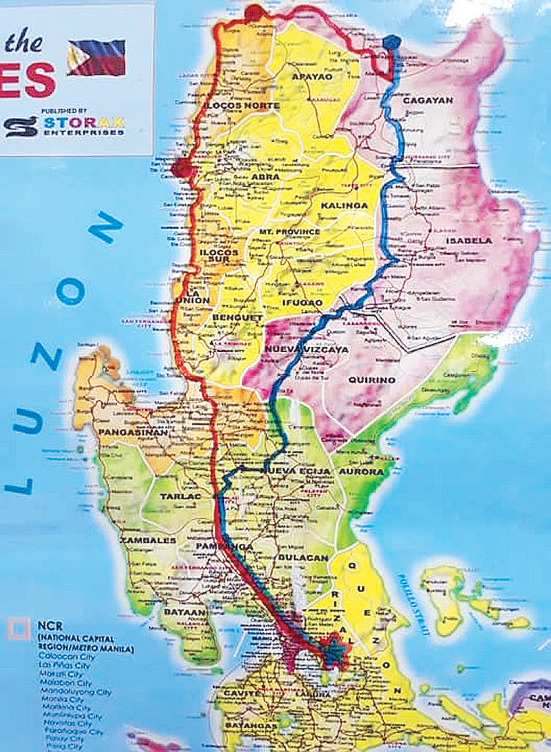
The author’s map shows red and blue lines tracing the route driven.
And so, after buzzer-beating Olaf’s coding on the EDSA-Balintawak area, we cruised through the North Luzon Expressway, Subic-Clark-Tarlac Expressway, Tarlac-Pangasinan-La Union Expressway, Manila North Road and McArthur Highway for about 430 kilometers in 11 hours. We decided to spend the night at the Heritage Village in Vigan City, Ilocos Sur and just proceed to Pagudpud the following day. Fortunately, there was room at the inn and we were able to walk in and book a room at the rustic Hotel Felicidad on Calle Florentino, despite it being the peak season for tourists.
Pictorials along Calle Crisologo and the Vigan Cathedral for my Facebook travel journalism page Pinas 360, a P150 one-hour tartanilla (horse-drawn carriage) ride for sightseeing around the city and a quick museum visit were on the itinerary the following morning.
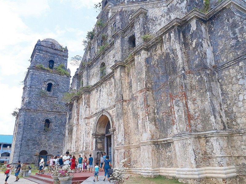
Checking out before noon on Holy Wednesday, I suggested we drop by and a say a little prayer at the picturesque Paoay Church, which was just 19 kilometers or 26 minutes away from Laoag City, where we would have lunch before the real trip to Pagudpud. By 3 p.m., we were on the road again, this time, taking the Maharlika Highway or Pan-Philippine Highway (marked “AH26” on the sides) which starts right across the Ilocos Norte capitol building.
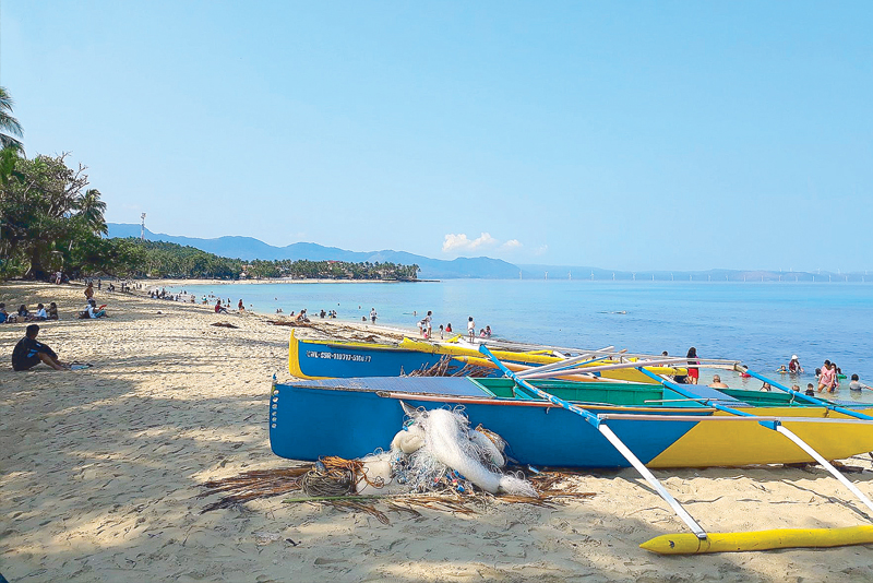
White sand and the inviting waters of Barangay Saud in Pagudpud.
During the two and a half hours on the road, Matty feasted on the mountainous greenery of Ilocos Norte, larger-than-life superhero characters on roadside display, Cape Bojeador lighthouse in Burgos and the windmills of Bangui scattered around the landscape, while sudden heavy downpours erratically alternated with the bright sunshine.
It was almost twilight on the Bangui Bay horizon when we arrived and managed to immediately get an overnight homestay accommodation just outside Saud Beach Resort. Olaf said I had driven 170 kilometers for the day.
Maundy Thursday morning was all about wading in Saud beach waters, a bit of sunbathing, sandcastle building for Matty and, of course, lots of photo ops and selfies and groupfies.
Now, where do we go from Pagudpud? Do we head home or go somewhere else? What route do we take? We had the weekend ahead of us, and it seemed a pity not to make the most of it.
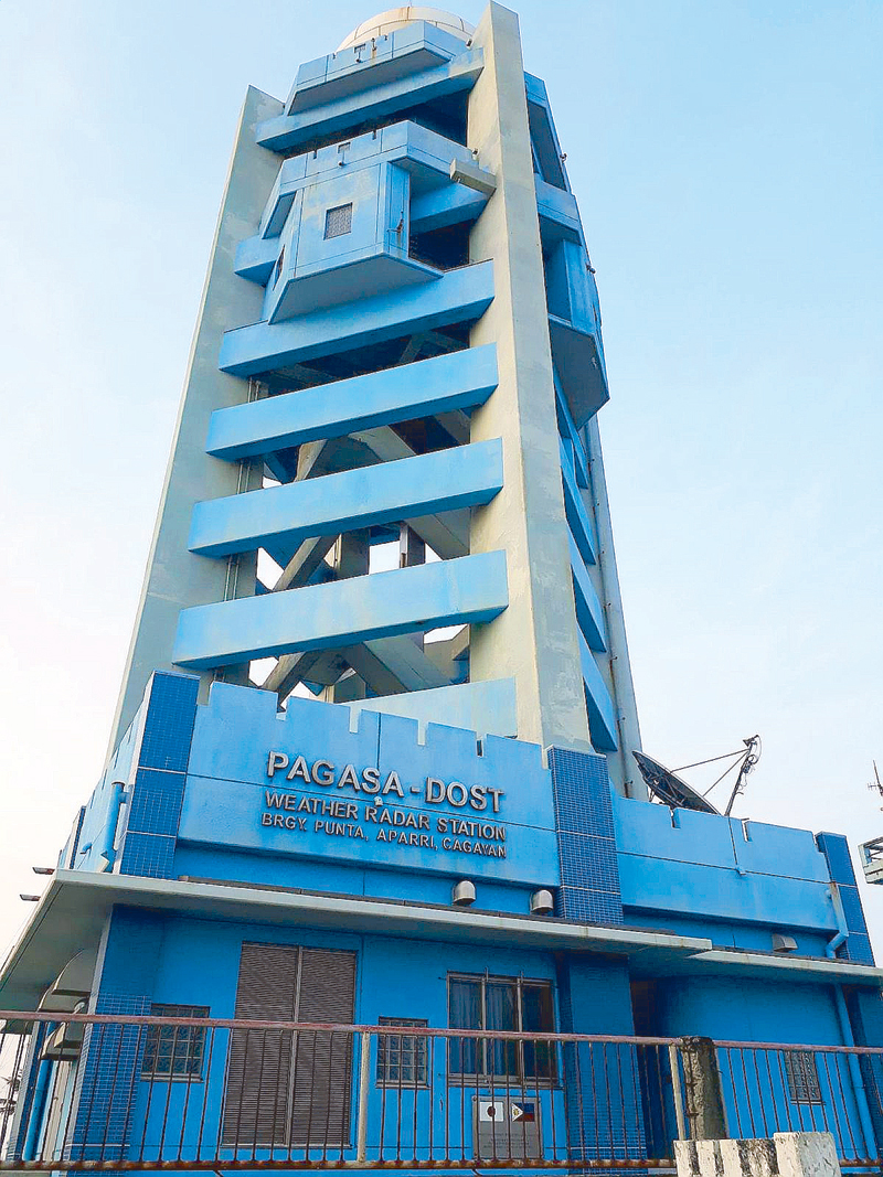
PAGASA-DOST’s Weather Radar Station in coastal Barangay Punta in Aparri.
In the end, we decided to go further north, up to Aparri in Cagayan province. We passed through the Patapat viaduct on the northern end of the Carballo mountains, which gave us a breathtaking view of Pasaleng Bay/Babuyan Channel and led us to the zigzag road of Santa Praxedes, the first town in Cagayan province after leaving Ilocos Norte.
The 205-kilometer trip to Aparri took some three hours. After a much-deserved merienda in one of the local restaurants in the town’s central area, I prodded my friend Raffy, who incidentally was on vacation at their home in Barangay Toran, to take me around and make sure I would have sufficient photo proof that I reached the northernmost tip of mainland Luzon. We called it a night at Hotel Dian, located near downtown, along the highway.
Good Friday was one of the highlights of the family excursion, as I allotted the entire day for the drive back home. Waze computed the distance and travel time from Aparri to Angono – 610 kilometers in 13 hours.
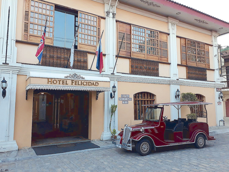
Period lodgings at Hotel Felicidad along Calle Florentino in Vigan City, Ilocos Sur.
Olaf began revving up outside Hotel Dian around 11:15 a.m. The drive took us through the municipalities of Camalaniugan, Lal-lo, Gattaran, Alcala, Amulung and Iguig. We stopped in Tuguegarao City – touted as the hottest place in the country – for a quick lunch and snapshots with Matty as we “enjoyed” the 41ºC breeze.
We were in Isabela when the afternoon sun started setting and I felt the need to take stretching breaks to soothe my complaining neck and right knee. By nightfall, I was negotiating Dalton Pass, the zigzag road in Santa Fe, Nueva Vizcaya, then crossed over to Nueva Ecija via Carranglan. Our final stop before a straight drive to Angono was in downtown San Jose, Nueva Ecija, as a bathroom break and a light dinner were in order.
At 12:17 a.m. of Black Saturday, Olaf was comfortably parked in our garage, none the worse for the long, arduous journey. My mom and Matty were ready to hit the sack. I too was hearing the siren call of my bed, but I had to do one more thing to complete my adventure – I checked the odometer, which read 33,176 kilometers. That’s a total driving distance of 1,415 kilometers, just me and Olaf, the sun, the road and the wide open space of Northern Luzon. What a trip!
