'Pepito' intensifies into typhoon; 'Ofel' weakens to severe tropical storm
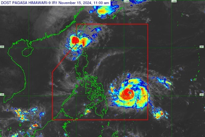
MANILA, Philippines — Pepito (Man-Yi) reached typhoon strength following “rapid intensification,” while Ofel (Usagi) weakened into a severe tropical storm on Friday morning, November 15, PAGASA reported.
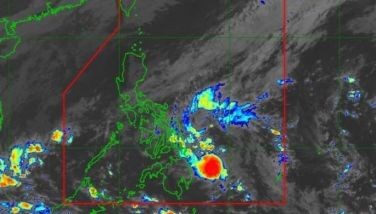
In an 11 a.m. bulletin, Typhoon Pepito was last located 620 kilometers east-northeast of Hinatuan, Surigao del Sur, packing peak winds of 130 kilometers per hour (kph) and gusts of up to 160 kph. PAGASA said it may further intensify into a super typhoon.
Meanwhile, Severe Tropical Storm Ofel was last located 215 kilometers northwest of Calayan, Cagayan, with maximum sustained winds of 110 kph and gusts reaching 135 kph.
Pepito is currently moving westward at 30 kph, while Ofel is moving north-northwestward at 20 kph.
Wind signals
PAGASA raised tropical cyclone wind signals over the following areas due to Typhoon Pepito:
Signal No. 2, gale-force winds (62 kph to 88 kph)
Visayas
- eastern portion of Northern Samar (Mapanas, Gamay, Palapag, Lapinig)
- northern portion of Eastern Samar (Arteche, Oras, San Policarpo, Dolores, Jipapad, Maslog)
Signal No. 1, strong winds (39 kph to 61 kph)
Luzon
- southeastern portion of Quezon (San Andres, Buenavista, San Narciso, Guinayangan, Tagkawayan)
- Camarines Norte
- Camarines Sur
- Catanduanes
- Albay
- Sorsogon
- Masbate
Visayas
- rest of Northern Samar
- rest of Eastern Samar
- Samar
- Biliran
PAGASA has lowered the highest tropical cyclone wind signal to Wind Signal No. 2 in northern Luzon due to Typhoon Pepito.
Signal No. 2, gale-force winds (62 kph to 88 kph)
- Batanes
Signal No. 1, strong winds (39 kph to 61 kph)
- northern portion of Cagayan (Pamplona, Claveria, Abulug, Sanchez-Mira, Santa Praxedes, Ballesteros)
- Babuyan Islands
- northern portion of Apayao (Luna, Santa Marcela, Calanasan)
- northern portion of Ilocos Norte (Pagudpud, Adams, Bangui, Dumalneg, Burgos, Pasuquin, Vintar, Bacarra, Piddig, Carasi)
Storm surge, sea conditions
Pepito. The state weather bureau issued a warning of moderate to high-risk, life-threatening storm surges, with heights potentially reaching up to 3.0 meters above normal tide levels.
Affected coastal areas include southeastern Quezon, Camarines, Catanduanes, Albay, Sorsogon, northern Masbate (including Burias and Ticao Islands), as well as Northern Samar, Eastern Samar, Samar, and northern Biliran.
While no gale warning has been issued yet for Typhoon Pepito, PAGASA said coastal waters in the affected provinces are very rough, with wave heights potentially reaching 8.0 meters.
Ofel. The state weather bureau no longer warned of storm surges due to Ofel. However, a gale warning is still hoisted over the northern seaboard of Northern Luzon.
In the next 24 hours, rough seas in Northern Luzon are expected to reach up to 4.0 meters in affected areas, including Batanes, Babuyan Islands, Ilocos Norte, and mainland Cagayan.
Sea travel is strongly discouraged, and mariners of motorbancas and small vessels are advised to take precautionary measures amid current sea conditions.
Track, intensity outlook
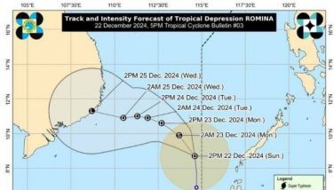
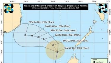
Typhoon Pepito is anticipated to move west-northwestward in the next five days and make landfall in the vicinity of Catanduanes on Saturday evening, November 16, or Sunday morning, November 17.
However, PAGASA said it is possible for Pepito to make landfall over the following areas due to the “limits of the forecast confidence cone”:
- eastern coast of Camarines Sur, Albay
- Sorsogon
- Eastern coast of Northern Samar
- Eastern coast of Quezon
- Aurora
The state weather bureau also emphasized that areas not expected to be directly impacted by Typhoon Pepito could still face hazards on land and along coastal waters.
Pepito is forecast to weaken by November 17 as it moves over Central Luzon and may be downgraded to a severe tropical storm once it reaches the West Philippine Sea on Monday.
Meanwhile, Severe Tropical Storm Ofel will continue moving north-northwestward and is expected to exit the Philippine area of responsibility (PAR) by Friday afternoon, November 16.
However, it may reenter PAR if it shifts northeastward toward southern Taiwan. PAGASA also noted that wind signals may still be raised in parts of extreme Northern Luzon, even after Ofel leaves PAR.
- Latest
- Trending


