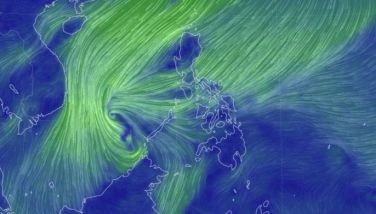
Signal No. 2 raised as 'Nika' develops into severe tropical storm
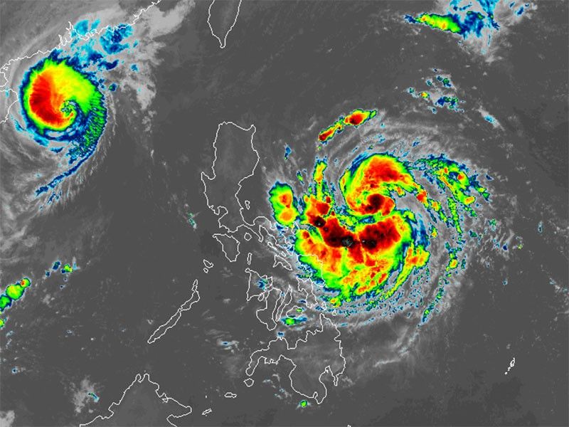
MANILA, Philippines — State weather bureau PAGASA has hoisted Signal No. 2 over two areas in Luzon as Nika (international name: Toraji) has intensified into a severe tropical storm on early Sunday, November 10.
As of 4 a.m., PAGASA reported that Nika was located 690 kilometers east of Infanta, Quezon.
It has peak winds of 100 kilometers per hour, gusts reaching up to 125 kph and a central pressure of 985 hPa.
Nika is moving west-northwest at 30 kph, and its powerful winds extend up to 300 kilometers from the center.
Wind signals
PAGASA hoisted the following tropical cyclone wind signals in the following areas in Luzon:
Signal No. 2
- southeastern portion of Isabela (Dinapigue)
- northern portion of Aurora (Dilasag, Casiguran, Dinalungan)
Residents of areas under Signal No. 2 could experience minor to moderate impacts from strong winds, with winds between 62 kph and 88 kph expected within at least 24 hours.
Signal No. 1
- southern portion of Cagaya (Tuguegarao City, Peñablanca, Enrile, Solana, Iguig)
- rest of Isabela
- Quirino
- Nueva Vizcaya
- southeastern portion of Kalinga (City of Tabuk, Rizal, Tanudan)
- eastern portion of Mountain Province (Paracelis, Natonin, Barlig)
- Ifugao
- eastern portion of Pangasinan (San Nicolas, Tayug, Natividad, San Quintin, Umingan)
- rest of Aurora
- Nueva Ecija
- northeastern portion of Pampanga (Candaba, Arayat)
- northern and eastern portions of Bulacan (Norzagaray, San Miguel, San Ildefonso, San Rafael, Doña Remedios Trinidad, Angat)
- eastern portion of Quezon (Calauag, Guinayangan, Tagkawayan, Pitogo, San Andres, Buenavista, San Francisco, Pagbilao, Infanta, Lopez, Catanauan, Mulanay, Unisan, General Luna, Plaridel, Quezon, Alabat, Sampaloc, Padre Burgos, Macalelon, Mauban, Perez, Agdangan, Gumaca, Atimonan, Real, San Narciso, General Nakar) including Polillo Islands
- Camarines Norte
- Camarines Sur
- Catanduanes
- northeastern portion of Albay (Malinao, Tiwi, Bacacay, City of Tabaco, Malilipot, Rapu-Rapu)
Strong winds ranging from 39 to 61 kph may be expected in at least 36 hours or intermittent rains may be expected within 36 hours.
Heavy rains, severe winds
PAGASA has issued a heavy rainfall outlook for the following areas over the next three days, warning residents of possible flooding and landslides:
Sunday, November 10
- Moderate to heavy rains (50-100 mm) in Catanduanes, Camarines Norte and Camarines Sur
Monday, November 11
- Intense to torrential rains (>200 mm) in Isabela, Cagayan and Aurora
- Heavy to intense rains (100-200 mm) in Apayao, Kalinga, Mountain Province, Quirino, Nueva Vizcaya, Ifugao and Abra
- Moderate to heavy rains (50-100 mm) in Catanduanes, Camarines Norte, Camarines Sur, Quezon, Nueva Ecija, Benguet, Ilocos Norte and Ilocos Sur
Tuesday, November 12
- Heavy to intense rains (100-200 mm) in Apayao, Kalinga, Abra, Mountain Province, Ifugao, Ilocos Norte and Ilocos Sur.
- Moderate to heavy rains (50-100 mm) in La Union, Pangasinan, Benguet, Nueva Ecija, Quirino, Cagayan, Isabela, Nueva Vizcaya and Aurora
The state weather bureau said the highest wind signal that may be raised due to Nika is Signal No. 4.
The northeasterly wind flow is expected to bring strong to gale-force gusts over the following areas in the coming days:
- Sunday, November 10: Batanes, Babuyan Islands, northern Cagayan and Ilocos Norte
- Monday, November 11: Batanes, Camarines Sur and Catanduanes
- Tuesday, November 12: Batanes and Cagayan including Babuyan Islands
Sea conditions
The state weather bureau has advised the public to avoid traveling by sea due to dangerous conditions in the following coastal water areas:
- Up to 4.5 meters: eastern seaboards of Isabela and northern Aurora; northern seaboard of Camarines Norte
- Up to 4 meters: seaboards northern and eastern seaboards of Polillo Islands; northern seaboard of Camarines Sur
- Up to 3.5 meters: northern seaboard of Catanduanes
- Up to 3 meters: remaining seaboard of Aurora; eastern seaboards of Babuyan Islands, mainland Cagayan, northern Quezon and Catanduanes
- Up to 2.5 meters: seaboards of Batanes and Ilocos Norte; remaining seaboards of Babuyan Islands and mainland Cagayan; eastern seaboards of Camarines Sur, Albay, and Sorsogon; remaining seaboards of Catanduanes; northern seaboard of Northern Samar.
- Up to 2 meters: remaining seaboards western and eastern seaboards of Luzon; eastern seaboards of Eastern Visayas and Dinagat Islands
Track, intensity outlook
Nika is expected to maintain its west-northwestward path and may make landfall over Isabela or Aurora by Monday, November 11.
While landfall could weaken the storm slightly, it may regain strength as it reemerges over the West Philippine Sea.
PAGASA said there is a possibility that Nika could reach typhoon status prior to landfall.
- Latest
- Trending


