Signal No. 5 still hoisted over parts of Batanes due to Super Typhoon Leon
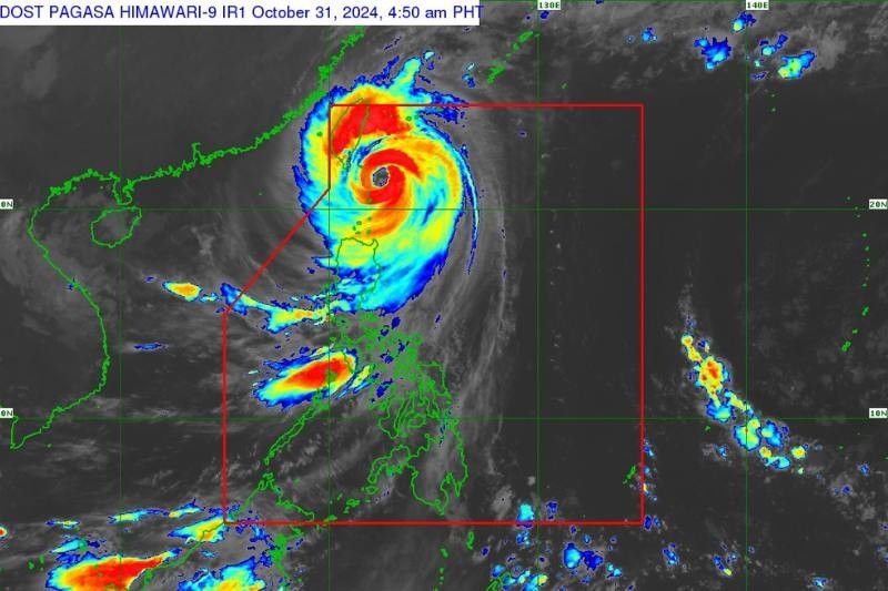
MANILA, Philippines — Parts of Batanes remain under Signal No. 5 as Super Typhoon Leon (international name: Kong-Rey) continues to severely impact the northernmost areas of Luzon.
According to PAGASA’s 5 a.m. bulletin on Thursday, October 31, Leon’s eye was located approximately 100 kilometers east-northeast of Itbayat, Batanes, packing maximum sustained winds of 195 kilometers per hour (kph) and gusts reaching up to 240 kph.
Leon, moving northwestward at 20 kph, is expected to remain close to Batanes in the coming hours.
The super typhoon’s powerful winds extend up to 600 km from its center, with typhoon-force conditions battering the eastern and northern parts of Batanes, and strong to gale-force winds affecting nearby areas.
Tropical Cyclone Wind Signal (TCWS) No. 5 has been hoisted in the northern and eastern portions of Itbayat and Basco, Batanes since 11 p.m. on Wednesday, October 30.
Areas currently under TCWS No. 5 face extreme threats to life and property from Leon's typhoon-force winds, with gusts ranging to 185 kph.
The rest of Batanes, meanwhile, is under TCWS No. 4 which winds can also pose a significant threat to life and property with gusts ranging from 118 kph to 184 kph.
Other portions of Babuyan Islands are under TWCS No. 3.
Below are the areas under TWCS No. 2:
- rest of Babuyan Islands
- mainland Cagayan
- northern portion of Isabela
- Apayao
- Ilocos Norte
Meanwhile, the following areas are under TWCS No. 1:
- rest of Isabela
- Quirino
- northern and central portions of Nueva Vizcaya
- Abra
- Kalinga
- Mountain Province
- Ifugao
- Benguet
- Ilocos Sur
- La Union
- Northern and central portions of Aurora
Storm surge, heavy rainfall
PAGASA has also highlighted the possibility of life-threatening storm surges reaching over three meters along coastal areas of Batanes and the Babuyan Islands.
Residents in low-lying or exposed areas are strongly advised to seek higher ground.
Heavy rainfall advisories are also in place, with potential flash floods and landslides in mountainous areas, particularly in the Cordillera Administrative Region, Quirino and other vulnerable localities.
Sea travel advisory
Sea travel is deemed extremely hazardous, with seas projected to reach heights of up to 14 meters off the coast of Batanes and 12 meters in Babuyan Islands.
Gale warnings are in effect over the seaboards of Northern Luzon and Central Luzon. Mariners are advised to remain in port, while small sea vessels and motorbancas are warned against navigating these dangerous waters.
Forecast track, intensity
Leon is forecast to approach Taiwan's eastern coast by Thursday afternoon , continuing northwestward before turning northward toward the East China Sea.
Although Batanes is unlikely to experience a direct landfall, severe weather impacts are still expected.
The super typhoon is anticipated to gradually weaken as it moves across Taiwan’s mountainous terrain, potentially decreasing in strength before its exit from the Philippine area of responsibility by Friday morning.
- Latest
- Trending


