Metro Manila, 30 other areas under Signal No. 2 due to 'Kristine'
MANILA, Philippines — Metro Manila and 30 other areas have been placed under Signal No. 2 due to Tropical Storm Kristine (international name: Trami).
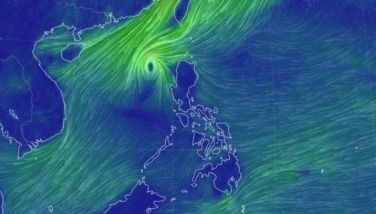
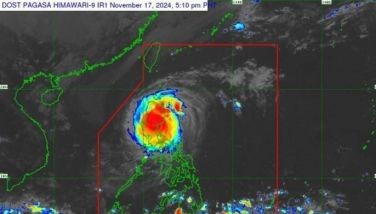
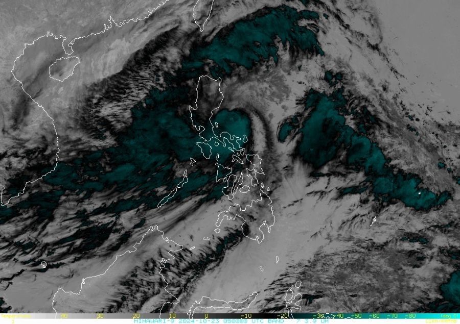
In Pagasa’s 11 a.m. forecast on Wednesday, October 23, Kristine is estimated at 255 kilometers (km) east of Baler, Aurora with winds peaking at 85 kph moving north northwest at 30 kph with gusts up to 105 kph.
The following are the other areas which Signal No. 2 is hoisted aside from Metro Manila:
- Ilocos Norte
- Ilocos Sur
- La Union
- Pangasinan
- Apayao
- Abra
- Kalinga
- Mountain Province
- Ifugao
- Benguet
- Cagayan including Babuyan Islands
- Isabela
- Quirino
- Nueva Vizcaya
- Aurora
- Nueva Ecija
- Bulacan
- Tarlac
- Pampanga
- Zambales
- Bataan
- Cavite
- Laguna
- Rizal
- Quezon including Polillo Islands
- Camarines Norte
- Camarines Sur
- Catanduanes
- Albay
- Northeastern portion of Sorsogon
Meanwhile, Signal No. 1 is raised in the following areas:
Luzon
- Batanes
- Batangas
- Occidental Mindoro including Lubang Islands
- Oriental Mindoro
- Marinduque
- Romblon
- Calamian Islands
- The rest of Sorsogon
- Masbate including Ticao and Burias Islands
Visayas
- Aklan
- Capiz
- Antique including Caluya Islands
- Iloilo
- Guimaras
- Northern portion of Negros Occidental:
- Northern portion of Negros Oriental:
- Northern and central portions of Cebu
- Bohol
- Eastern Samar
- Northern Samar
- Samar
- Leyte
- Biliran
- Southern Leyte
Mindanao
- Dinagat Islands
- Surigao del Norte including Siargao - Bucas Grande Group
Forecast track
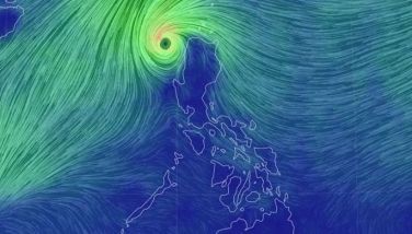
Kristine is expected to move generally northwestward over the next 12 hours before shifting to a westward trajectory.
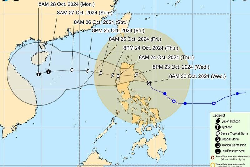
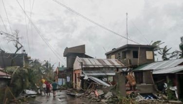
The storm is predicted to make landfall over Isabela tonight, bringing with it heavy rains and strong winds.
Kristine is forecast to cross the mountainous terrain of Northern Luzon, weakening slightly during its passage.
By the morning of October 24, the storm is expected to emerge over the waters west of the Ilocos Region. If the current forecast holds, Kristine may exit the Philippine area of responsibility by Friday, October 25.
Before it makes landfall, Kristine is expected to intensify into a severe tropical storm. While it may weaken slightly as it traverses Northern Luzon, it could re-intensify once it reaches the West Philippine Sea.
Winds
PAGASA has issued wind warnings indicating significant wind threats, particularly in coastal and mountainous areas.
Local winds are expected to intensify in regions exposed to the storm’s path, while areas sheltered from prevailing winds may experience slightly weaker gusts.
Regions under tropical cyclone wind signal No. 2 can expect gale-force winds with minor to moderate impacts on life and property.
Strong winds are likely to affect coastal and upland areas, potentially causing damage to infrastructure and vegetation.
Meanwhile. areas under tropical cyclone wind signal no. 1 will experience minimal to minor impacts from strong winds.
While the risk is less severe, residents should still remain vigilant for possible disruptions.
Wind Intensification
The highest possible wind signal that could be hoisted as Kristine moves inland is Signal No. 3, indicating the potential for even stronger winds and greater impact in its path.
In addition to Kristine’s direct influence, the approaching northeasterly windflow will further enhance strong to gale-force winds across various regions:
- October 23: Winds are expected to intensify across MIMAROPA, Visayas, and Mindanao.
- October 24: Strong winds will spread to MIMAROPA, Bicol Region, Visayas, Basilan, Sulu, Tawi-Tawi, Zamboanga del Norte, Lanao del Sur, Northern Mindanao, Dinagat Islands, Surigao del Norte, Davao del Sur, and Davao Oriental.
- October 25: Areas in MIMAROPA, Bicol Region, Western Visayas, Negros Occidental, Zamboanga del Norte, Basilan, Sulu, and Tawi-Tawi will continue to face strong to gale-force gusts.
Residents in these areas are advised to stay informed and take precautions, especially in regions highly vulnerable to severe wind impacts.


- Latest
- Trending