Signal No. 3 up over 2 areas as Typhoon Julian keeps strength
MANILA, Philippines — State weather bureau PAGASA has hoisted Signal Number 3 over two areas in northern Luzon as Typhoon Julian (international name: Krathon) maintained its strength while moving over the Philippine Sea.
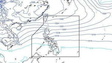
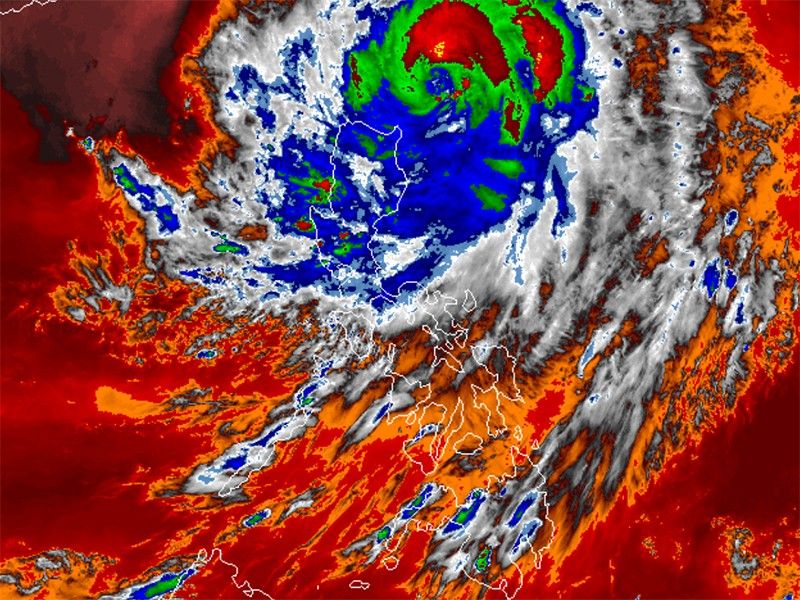
As of 4 p.m. on Sunday, September 29, PAGASA said that Julian was located 235 kilometers east of Calayan, Cagayan.
Moving northwestward at 15 kilometers per hour, the typhoon was carrying peak winds of 120 kph, gusting up to 150 kph and has a central pressure of 975 hPa.
Wind Signals
The following areas are under tropical cyclone wind signals:
Signal No. 3
- Batanes
- northeastern portion of Babuyan Islands (Babuyan Is.)
Winds between 89 kph and 117 kph are expected within at least 18 hours, with residents possibly experiencing moderate to significant impacts from strong winds.
Signal No. 2
- mainland Cagayan
- rest of Babuyan Islands (Camiguin Is., Calayan Is., Dalupiri Is., Fuga Is.)
- Apayao
- northern and central portions of Ilocos Norte (Pagudpud, Adams, Dumalneg, Bangui, Burgos, Pasuquin, Vintar, Carasi, Nueva Era, Solsona, Piddig, Dingras, Sarrat, San Nicolas, Laoag City, Bacarra)
Residents of areas under Signal No. 2 could experience minor to moderate impacts from strong winds, with winds between 62 kph and 88 kph expected within at least 24 hours.
Signal No. 1
- rest of Ilocos Norte
- Ilocos Sur
- La Union
- Abra
- Kalinga
- Ifugao
- Mountain Province
- Benguet
- Isabela
- Nueva Vizcaya
- Quirino
- northern and central portions of Aurora (Dilasag, Casiguran, Dinalungan, Dipaculao)
Winds between 39 and 61 kph may be expected in at least 36 hours or intermittent rains may be expected within 36 hours. Minimal to minor impacts from strong winds are anticipated.
Severe winds
The highest wind alert that may be issued is Signal No. 4.
PAGASA issued a warning for strong to gale-force gusts due to Typhoon Julian.
The following areas will be particularly affected by the strong winds:
- Sunday, September 29: Aurora, CALABARZON, Romblon and Bicol Region
- Monday, September 30: Pangasinan, Zambales, Bataan, Aurora, Quezon, Romblon and Bicol Region
Storm surges, sea conditions
PAGASA said there is a moderate to significant risk of storm surges in low-lying coastal areas of Batanes, Cagayan and Ilocos Norte within the next 48 hours.
The state weather bureau also warned mariners of hazardous sea conditions and risky travel for small vessels, including motorbancas in the following areas:
- Batanes: Up to 9 meters (very rough)
- Babuyan Islands: Up to 8 meters (very rough)
- northern Cagayan and Ilocos Norte: Up to 4.5 meters (rough)
- Isabela: Up to 3.5 meters (rough)
Track and intensity outlook
Julian is expected to move toward the Batanes-Babuyan Islands area, with a potential landfall or close approach anticipated by Monday.
PAGASA warned the typhoon will likely intensify over the next 24 to 36 hours. It might reach the super typhoon status.


- Latest
- Trending