Signal No. 2 raised over 2 areas as ‘Julian’ intensifies into severe tropical storm
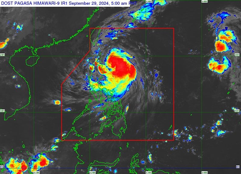
MANILA, Philippines — Signal No. 2 was hoisted in some areas as tropical cyclone Julian (international name: Krathon) intensified into a severe tropical storm, the state weather bureau PAGASA said on Sunday, September 29.
In its 5 a.m. forecast, the severe tropical storm was spotted 305 kilometers east of Aparri, Cagayan.
Julian was moving west-northwest at 10 kilometers per hour (kph), with peak winds of 95 kph near its center and gusts of up to 115 kph.
The state weather bureau raised tropical cyclone wind signals over the following areas:
Signal No. 2
- northeastern portion of Mainland Cagayan (Santa Ana)
- eastern portion of Babuyan Islands (Camiguin Island, Babuyan Islands).
According to PAGASA, high-risk structures may experience light to moderate damage, while medium-risk structures could experience very light to light damage in the areas under Signal No. 2.
PAGASA warned that sea and coastal waters are hazardous for small seacrafts. Travelers by sea and air are also cautioned to avoid taking unnecessary risks.
Signal No. 1
- Batanes
- rest of Cagayan
- rest of Babuyan Islands
- Isabela
- Apayao
- Abra
- Kalinga
- eastern and central portions of Mountain Province (Natonin, Paracelis, Sadanga, Barlig, Bontoc)
- eastern portion of Ifugao (Aguinaldo, Alfonso Lista, Mayoyao),
- Ilocos Norte
- northern portion of Ilocos Sur (Sinait, Cabugao, San Juan, Magsingal, Santo Domingo, Bantay, San Ildefonso, San Vicente)
- northern portion of Aurora (Dilasag, Casiguran)
According to the state weather bureau, low-risk structures are expected to experience very light or no damage, while medium to high-risk structures may sustain light damage in these areas.
Slight damage could occur to houses of light materials or makeshift structures in exposed areas.
Metro Manila and the rest of Luzon may anticipate partly cloudy to cloudy skies with isolated rain showers or thunderstorms due to the trough of Julian.
Meanwhile, the rest of the country is expected to have partly cloudy to cloudy skies with isolated rain showers or thunderstorms due to localized thunderstorms.
Julian is expected to keep strengthening and may become a typhoon by Sunday night or Monday early morning.
The storm will likely move northwest toward the Batanes-Babuyan Islands, with a possible landfall or close approach on Monday.
Julian could become a super typhoon, according to PAGASA.


- Latest
- Trending