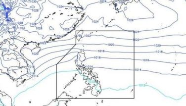
Tropical storm “Helen” has slightly intensified as it continued to move toward extreme Northern Luzon.
As 4 p.m. yesterday, the center of “Helen” was estimated at 170 kms east of Aparri, Cagayan with maximum sustained winds of 75 kph near the center and gustiness of up to 980 kph. It is expected to be at 100 kms north-northeast of Aparri this afternoon.
Batanes, Apayao and Cagayan, including the Calayan group of islands and Isabela, will have stormy weather with rough to very rough seas.
The provinces of Ilocos Norte, Abra, Kalinga, Mt. Province, Ifugao, Nueva Vizcaya, Quirino and Aurora will have rains and gusty winds and moderate to rough coastal waters.
The rest of Luzon will be cloudy with scattered rainshowers and thunderstorms, becoming widespread rains over the western section of Luzon.
The rest of the country will be partly cloudy to cloudy with isolated rainshowers or thunderstorms, mostly in the afternoon or evening.
Coastal waters in Luzon and the Visayas will be moderate to rough. Elsewhere, seas will be slight to moderate, except during thunderstorms.
Temperature forecasts: Metro Manila, 23-30 degrees Celsius; Baguio City, 14-18; Tagaytay City, 20-26; Subic and Clark zone, 22-27; Metro Cebu, 25-32; Metro Davao, 25-32; and Cagayan de Oro, 22-31.
Tidal predictions in Manila Bay: high tide at 8:02 a.m. at 1.23 meters; low tide at 5:20 p.m. at 0.03 meter. Sunrise is at 5:35 a.m.; sunset at 6:29 p.m.