More areas in Luzon, Visayas placed under Signal No. 1; Heavy to intense rain seen

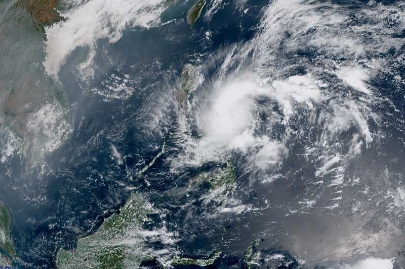
MANILA, Philippines — State weather bureau PAGASA placed more areas in Luzon and Visayas under Wind Signal No. 1 as Tropical Depression Amang moved toward Bicol region.
The country’s first cyclone of the year was last spotted 270 kilometers east of Virac in Catanduanes, with peak winds of 55 km per hour and gusts of up to 70 kph, PAGASA said in a bulletin issued past 11 a.m.
Amang was heading west toward Bicol region. Weather forecasters are not ruling out the possibility of a landfall in the region.
PAGASA placed the following areas under Wind Signal No. 1:
Luzon
- Catanduanes
- Sorsogon
- Albay
- Camarines Sur
- Camarines Norte
- Quezon (Pitogo, San Andres, Buenavista, San Francisco, Calauag, Infanta, Lopez, Catanauan, Mulanay, Guinayangan, Unisan, General Luna, Plaridel, Quezon, Alabat, Sampaloc, Padre Burgos, Macalelon, Mauban, General Nakar, Perez, Agdangan, Gumaca, Atimonan, Real, San Narciso, Tagkawayan, Pagbilao, City of Tayabas) including Pollilo Islands
- Marinduque
- Masbate including Ticao Island, Burias Island
Visayas
- Eastern Samar
- Northern Samar
- Samar
- Biliran
Wind Signal No. 1 may be raised in other areas in Eastern Visayas and Bicol region.
What to expect
According to state weather forecasters, areas under Wind Signal No. 1 may experience strong winds that may pose “minimal to minor threat to life and property.”
Intense rain will drench Northern Samar, and the northern portions of Samar and Eastern Samar today. Meanwhile, heavy rain will affect the rest of Samar provinces.
Until Thursday evening, residents of Bicol region, Northern Samar, and the northern portions of Samar and Easter Samar will experience intense rain, while the southern portion of Quezon and the rest of Samar island will have heavy rain.
PAGASA warned that flooding and rain-induced landslides are possible under these conditions.
The state weather bureau also issued a marine gale warning over the eastern seaboards of Catanduanes and Eastern Samar, and the northern and eastern seaboards of Northern Samar, indicating rough sea conditions.
Fishing boats and other small vessels are advised not to venture out into the sea, while larger sea vessels are alerted against big waves.
Tropical Depression Amang is forecast to remain over the waters east of Luzon for the next three days. However, the forecast confidence cone shows that a landfall scenario in the Bicol peninsula is not ruled out, especially in the next 36 hours.
Amang is likely to remain a tropical depression throughout the forecast period, and may weaken into a low pressure area by late Thursday or early Friday.
Forecast position
- Apr 11, 2023 8:00 PM - 125 km east northeast of Virac, Catanduanes
- Apr 12, 2023 8:00 AM - 165 km east of Daet, Camarines Norte
- Apr 12, 2023 8:00 PM - 230 km east of Infanta, Quezon
- Apr 13, 2023 8:00 AM - 190 km east Northeast of Infanta, Quezon
- Apr 13, 2023 8:00 PM - 150 km east of Baler, Aurora
- Apr 14, 2023 8:00 AM - Over the coastal wates of Casiguran, Aurora
- Latest


