How the Philippine Space Agency is helping clean up the Mindoro oil spill

MANILA, Philippines — Satellite images released by the Philippine Space Agency (PhilSA) are important tools that can aid authorities in the cleanup and containment of the oil spill off Oriental Mindoro, agency officials said Tuesday.
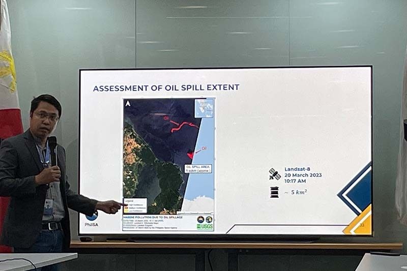
PhilSA processes satellite images and maps showing the progression and the scope of areas affected by the oil spill. The agency gives the Philippine Coast Guard and the Department of Environment and Natural Resources copies of these maps for guidance.
Dr. Gay Jane Perez, deputy director general of PhilSA, said the satellite images can help respondents come up with proper interventions.
"Knowing the extent can guide them in their efforts, where they need to employ containment booms or tools, especially for Coast Guard’s offshore [response]," Perez said, noting the agency is "coordinating closely" with authorities.
Trajectory models
Satellite images provided by PhilSA also aid institutions such as the University of the Philippines-Marine Science Institute in developing oil spill trajectory models.
"Models are helpful in giving advisory where the oil spill is projected to flow so communities who will be affected will be prepared," Perez said.
The latest satellite image processed by PhilSA shows the detection of oil slicks along Verde Island Passage, which is known for its rich marine life.
Engineer Roel de la Cruz of the Philippine Space Agency says a March 27 satellite image shows the detection of oil slicks along Verde Island Passage, which is known for its rich marine life. @PhilstarNews pic.twitter.com/v3WUKe7s5W
— Gaea Cabico (@gaeacabico) March 28, 2023
MT Princess Empress was carrying 800,000 liters of industrial oil when it sank off Oriental Mindoro on February 28. The oil spill is threatening not only the area’s rich marine biodiversity, but it is also disrupting the livelihoods of locals.
Better use of satellite images
Jamaica Pangasinan, senior science research specialist of PhilSA’s Space Mission Control Operations Division, acknowledged the need for better coordination in the utilization of satellite images.
"The field of space is very new to the Philippines. In PhilSA, it’s mainly our job. But for other agencies, I suppose it’s a small percentage of their operations. For example, for some agencies, satellite image is just one tool among many that they use in disaster response," Pangasinan said.
"Right now, we’ve seen many capabilities already in different agencies, departments, and even universities. It will help if these agencies will also develop their own and improve," she added, noting that PhilSA holds training on the use of satellite images.
The DENR recently partnered with the PhilSA to create a national environment and natural resources geospatial database that will aid the environment department in the implementation of projects such as the National Greening Program and the Environment and Natural Resource Accounting Program.
PhilSA is an attached agency of the Office of the President mandated to plan, develop, and promote the nation's space program.
- Latest


