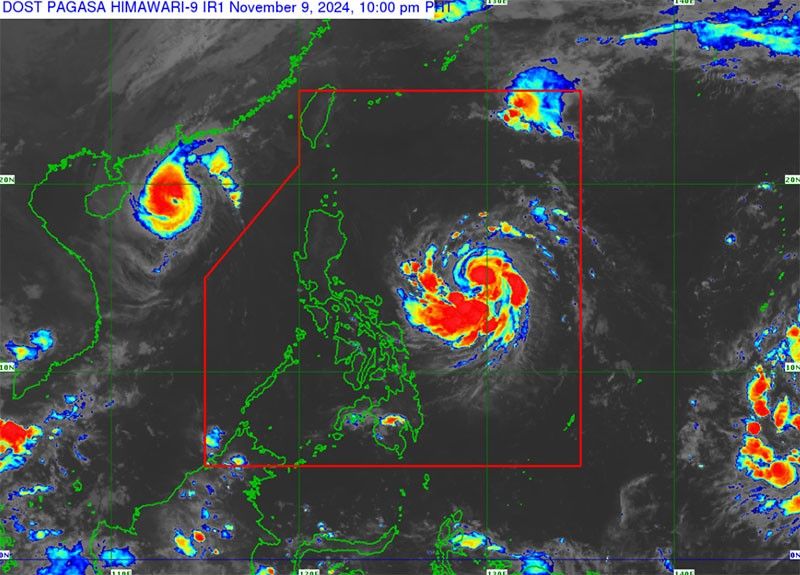
Nika to make landfall; another LPA monitored

MANILA, Philippines — Tropical storm Nika could intensify into a severe tropical storm as it was forecast to make landfall and tread Luzon tomorrow, according to the Philippine Atmospheric, Geophysical and Astronomical Services Administration.
PAGASA said Nika will make landfall over Isabela or Aurora as it moves northwestward. It was last monitored 1,205 kilometers (km) east of southeastern Luzon yesterday, packing maximum sustained winds of 65 km per hour and gustiness of up to 80 kph.
Tropical cyclone wind signal no. 1 has been raised over the southeastern portion of Isabela, the northern portion of Aurora, Pollilo Islands, Camarines Norte, Camarines Sur, Catanduanes and the northeastern portion of Albay as Nika makes its way towards the Philippine landmass.
State weather forecasters said tropical cyclone wind signal no. 3 may be the highest signal raised during Nika’s passage.
Nika is currently bringing rains and gusty winds over Catanduanes while its trough is causing scattered rains over the rest of Bicol Region and Quezon.
Localized thunderstorms will bring isolated rains over Metro Manila and the rest of the country.
PAGASA warned of possible flooding or landslides during intense rains.
Meanwhile, PAGASA is monitoring another low-pressure area (LPA) outside of the Philippine area of responsibility that could develop into a cyclone.
The LPA was last monitored 2,700 km east of Northern Mindanao and has a medium chance of developing into a cyclone today.
- Latest
- Trending


