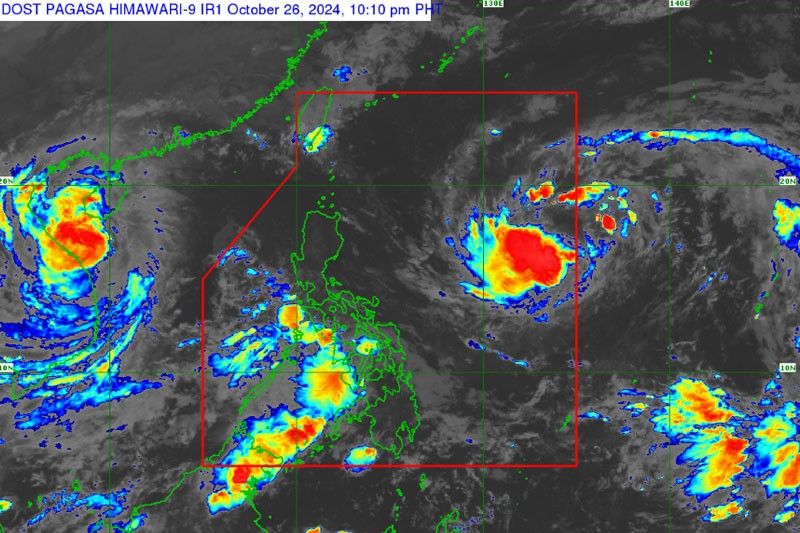
Another tropical storm threatens to enter PAR

MANILA, Philippines — Another tropical storm was forecast to enter the Philippine area of responsibility (PAR) last night and could intensify into typhoon category in the next few days.
The cyclone, with international name Kong-rey, was monitored 1,825 kms east of Central Luzon as of 3 p.m. yesterday.
It was packing maximum sustained winds of 65 kph near the center and gustiness of up to 80 kph.
The tropical storm will be named Leon once it enters PAR. It is expected to remain far from the Philippine landmass as it is forecast to reach severe tropical storm category today and become a typhoon by Monday.
Its outer rainbands could affect extreme Northern Luzon, depending on how close it will be to the landmass during its passage over the Philippine Sea.
It is expected to influence the southwesterly windflow that was triggered by Kristine, which has reached typhoon category, and may affect the western section of Southern Luzon, the Visayas and Mindanao in the coming days.
Kristine could still reloop and turn towards PAR but PAGASA said it will only enter as a remnant low-pressure area.
The southwesterly windflow will bring scattered rains over Western Visayas, Negros Island Region, Zamboanga Peninsula, Occidental Mindoro and Palawan.
Meanwhile, localized thunderstorms may also bring isolated rains over Metro Manila and the rest of the country.
- Latest
- Trending


