Tropical Storm Kong-Rey to enter PAR soon, may develop into typhoon by Monday
MANILA, Philippines — Tropical Storm Kong-Rey is expected to enter the Philippine area of responsibility (PAR) on Saturday night or Sunday morning.
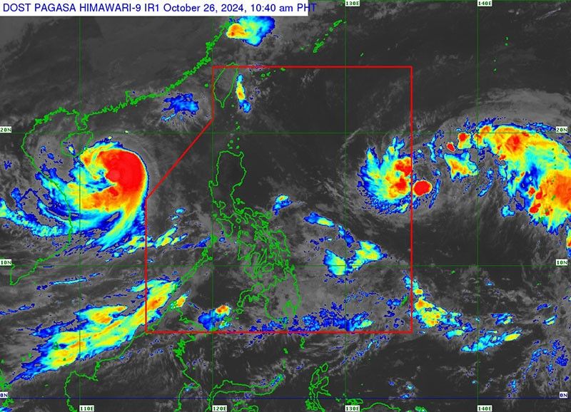
Once it enters the PAR, state weather bureau PAGASA said the cyclone will be named "Leon."
As of 10 a.m. on Saturday, October 26, Kong-Rey was spotted 1,630 kilometers east of Central Luzon.
Kong-Rey is carrying peak winds of 65 kilometers per hour and gusts reaching 80 kph. It is is moving west at 30 kph.
According to PAGASA, Kong-Rey will track westward through the weekend, gradually intensifying into a severe tropical storm by Sunday and possibly a typhoon by Monday.
Its projected path will stay far from the Philippine landmass, though it may shift slightly within the forecast cone over the next five days.
Kong-Rey’s outer rainbands may affect areas in Extreme Northern Luzon, depending on its trajectory within the PAR.
The storm could also enhance the existing southwest monsoon, bringing rain to the western parts of Southern Luzon, Visayas and Mindanao in the coming days.
Moderate to rough seas are expected along northern and eastern coastlines in Luzon and the eastern seaboard of Visayas


- Latest
- Trending