PAGASA: Kristine may reloop back to PAR
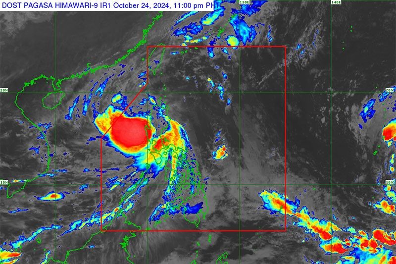
MANILA, Philippines — Severe Tropical Storm Kristine maintained its strength as it roared through Northern Luzon yesterday and is now making its way over the West Philippine Sea (WPS).
The Philippine Atmospheric, Geophysical and Astronomical Services Administration (PAGASA) said there is a developing chance that Kristine could reloop over the WPS back toward the Philippine area of responsibility (PAR) by Sunday or Monday.
Kristine is forecast to exit PAR this afternoon but its reloop still depends on the behavior of another weather disturbance east of PAR that is expected to develop into a tropical depression.
Kristine is expected to re-intensify as it moves over the West Philippine Sea and could still reach typhoon category.
The cyclone was monitored over the coastal waters of Santa Lucia, Ilocos Sur as of 5 p.m. as it moves westward slowly.
It was carrying maximum sustained winds of 95 km/h near the center and gustiness of up to 115 km/h.
Tropical cyclone wind signal No. 3 was still raised over Ilocos Sur, La Union and Pangasinan with winds of greater than 89 km/h up to 117 km/h expected.
Signal No. 2 was raised over Cagayan including Babuyan Islands, Isabela, Quirino, Nueva Vizcaya, Apayao, Kalinga, Abra, Ifugao, Mountain Province, Benguet, Ilocos Norte, Aurora, Nueva Ecija, Tarlac, Zambales, Bataan, Pampanga and Bulacan.
Meanwhile, signal No. 1 was raised over Batanes, Metro Manila, Rizal, Batangas, Laguna, Cavite, Quezon, Occidental Mindoro, Oriental Mindoro, Marinduque, Romblon, the northern portion of mainland Palawan, including Calamian Islands, Cuyo and Kalayaan Islands, Camarines Norte, Camarines Sur, Catanduanes, Albay, Sorsogon, and Masbate including Ticao and Burias Islands.
PAGASA warned that there could be minimal to moderate risk of storm surge with peak heights of around 1.0 to 2.0 m above normal tide levels.
This could be experienced in the next 48 hours over the low-lying or exposed coastal localities of Ilocos Sur, La Union, Pangasinan, Cagayan, Isabela, Aurora and Zambales.
In its tropical cyclone threat potential advisory, PAGASA said there is a high chance that a tropical cyclone will enter PAR in the next two weeks.


- Latest
- Trending