


Super Typhoon Julian further intensifies, may reenter PAR
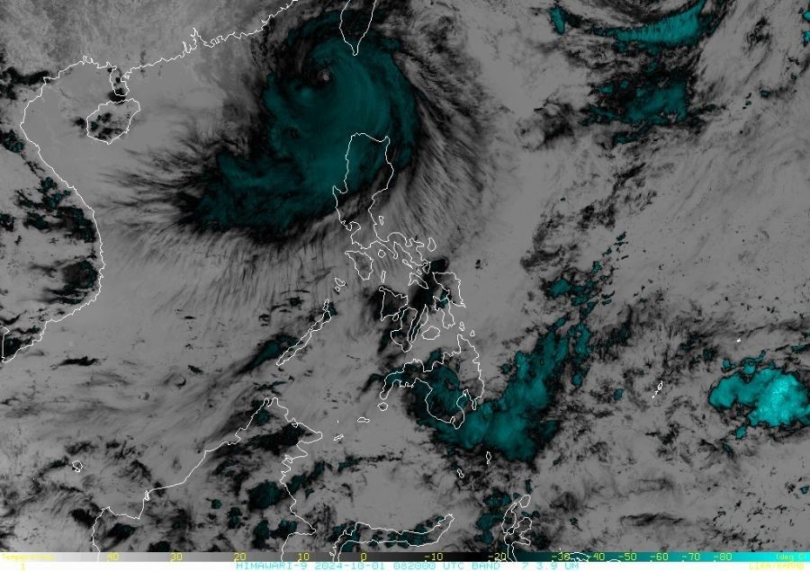
MANILA, Philippines — Super Typhoon Julian (international name: Krathon) has slightly gained strength by midday on Tuesday, October 1.
While it is already outside the Philippine area of responsibility (PAR), it is likely to reenter the zone tomorrow, according to state weather bureau PAGASA.
As of 4 p.m., the eye of the powerful cyclone was located 245 kilometers west of Itbayat, Batanes. It packs maximum sustained winds of 195 kilometers per hour (kph) near the center, with gustiness of up to 240 kph.
It is currently moving westward at a slow pace.
Tropical Cyclone Wind Signals
PAGASA has raised the following wind signals:
Signal No. 2 (62-88 kph winds or gale-force winds in 24 hours):
- Batanes
- Babuyan Islands
- Northern portion of Ilocos Norte (Bacarra, Pasuquin, Bangui, Vintar, Burgos, Pagudpud, Dumalneg, Adams)
- Northwestern portion of mainland Cagayan (Santa Praxedes, Claveria, Sanchez-Mira)
Signal No. 1 (39-61 kph winds or strong winds in 36 hours):
- Rest of Ilocos Norte
- Ilocos Sur
- La Union
- Pangasinan
- Several provinces in the Cordillera Administrative Region
- Rest of mainland Cagayan
- Isabela
- Quirino
- Nueva Vizcaya
- Northern portion of Aurora (Dilasag, Casiguran, Dinalungan)
- Northern portion of Nueva Ecija (Carranglan, Lupao, Pantabangan)
Forecast track
Julian is expected to recurve toward the sea southwest of Taiwan today through tomorrow morning.
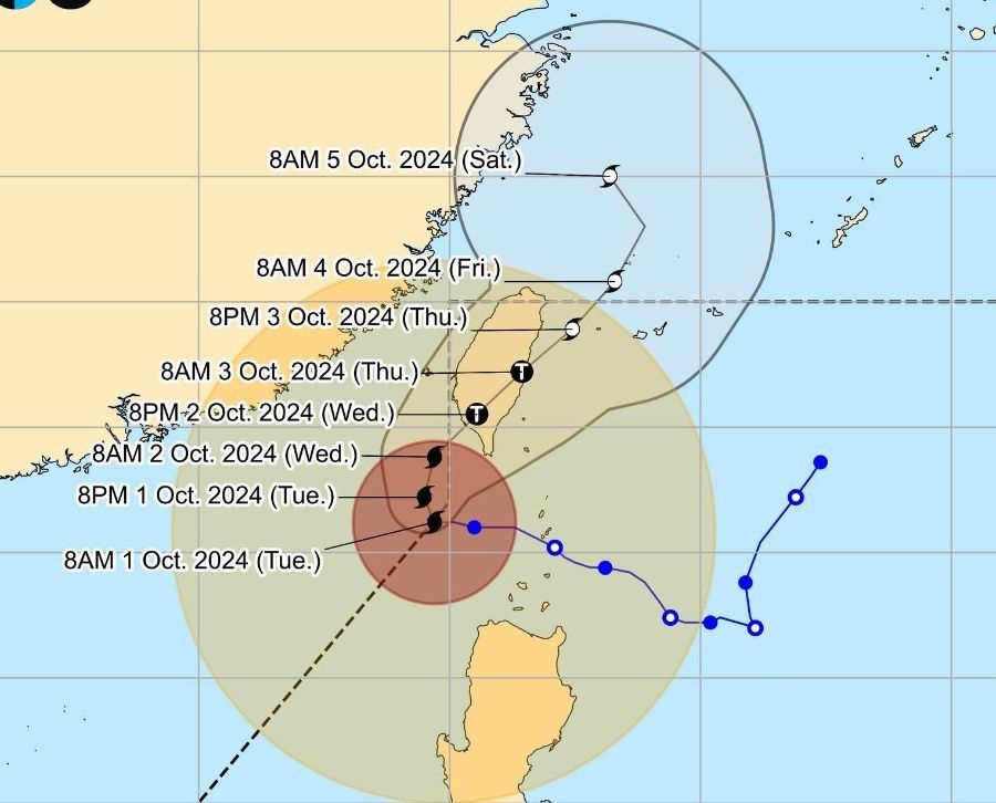
It is forecast to make landfall along the southwestern coast of Taiwan tomorrow morning or afternoon.
After crossing Taiwan, the typhoon will move northeastward towards the East China Sea and exit the PAR on Thursday evening or Friday early morning.
The super typhoon may briefly intensify in the next 18 hours before weakening slightly due to interaction with Taiwan's terrain, PAGASA said. It is expected to be downgraded to a severe tropical storm by Thursday.


- Latest
- Trending


