DND gets copy of 1875 map of Philippines
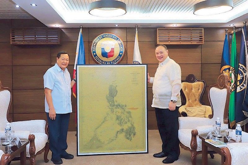
MANILA, Philippines — Defense Secretary Gilberto Teodoro Jr. recently received a print of an 1875 map of the Philippines, which shows its territories during the Spanish regime, including Scarborough (Panatag) Shoal and the Spratlys.
Teodoro received the copy of the 1875 Carta General del Archipielago Filipino from retired Supreme Court senior associate justice Antonio Carpio during the latter’s courtesy call last Aug. 14.
Carpio was part of the team that won the 2016 Arbitral
Ruling, which invalidated China’s nine-dash line claim in South China Sea.
The 1875 map was described as “the most complete and detailed official map of Philippine territory during the Spanish regime.”
Based on the description released by the Department of National Defense (DND), the original map was published in Madrid by the Direccion Hydrografia, the charting office of the Spanish government.
It was made under the direction of Capt. Claudio Montero, the first head of the Philippine Hydrographic Commission during the Spanish regime.
The 1875 map contains minor corrections from an earlier version published in 1808, with the newer one containing “depth soundings in many islands, including in Scarborough Shoal and the Spratlys.”
“The United States adopted and reissued this 1875 map four times as the official map of Philippine territory during the American regime. In the famous 1928 Islas Palmas arbitration case between the United States and the Netherlands involving the sovereignty of Islas Palmas, the United States stated in its Memorandum that this 1875 map ‘is both an American official and a Spanish official map,’” the map’s description read.
The 1808 and 1875 maps, along with the earlier Murillo Velarde 1734 map, were used by the Philippines in its arbitration case against China as they prove that features such as Scarborough and Spratlys are part of Philippine territory.
Later this month, the public will also be able to view the original copy of the Murillo Velarde 1734 Map at the Permanent Gallery of the National Library of the Philippines in Manila.


- Latest
- Trending