More rain than 'Ondoy' but less intense: Why 'Carina'-enhanced habagat submerged Luzon
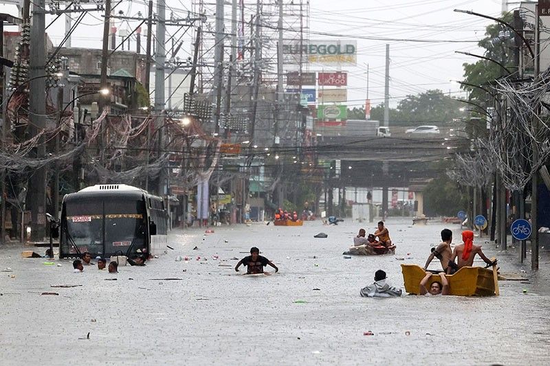
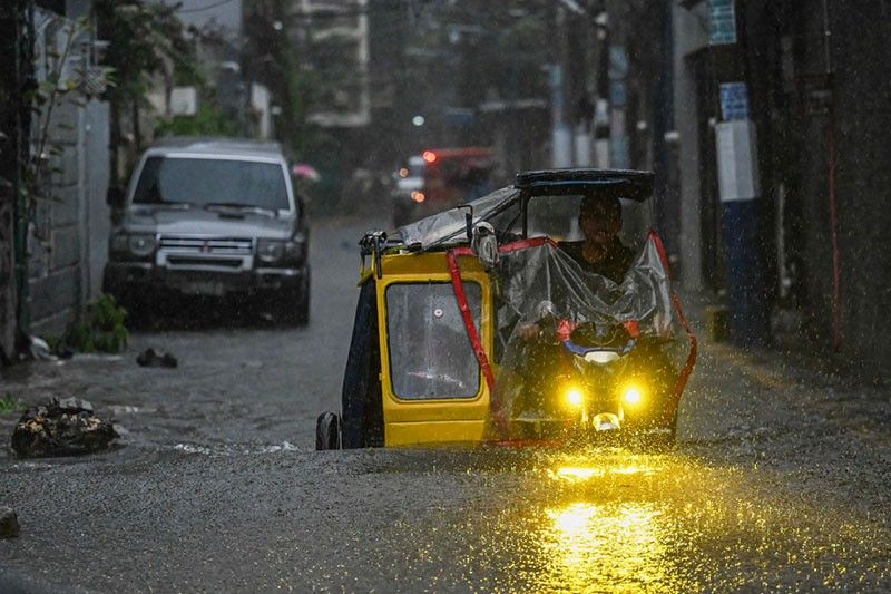
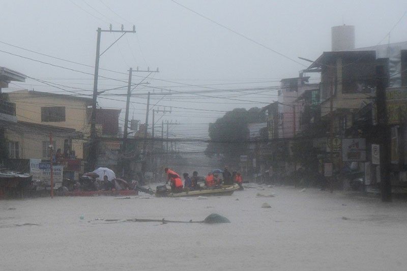
MANILA, Philippines — This week's devastating floods from Typhoon Carina (international name: Gaemi) enhanced by the southwest monsoon have caused people to relive their memories of Typhoon Ondoy in 2009, which similarly poured enough rain to engulf whole cities and turn streets into rivers.
Data from state weather bureau PAGASA show that these comparisons are not without basis.
Based on the agency's Science Garden station in Quezon City, the Carina-enhanced habagat dumped 471 millimeters of rainfall between Wednesday midnight to Thursday midnight, surpassing the 455 millimeters recorded within 24 hours during Ondoy.
But for Gerry Bagtasa, professor of at the University of the Philippines Diliman's Institute of Environmental Science and Meteorology, both the overall amount of rainfall and how fast it falls matters.
Bagtasa told Philstar.com that Ondoy's rain rate, or the amount of rainfall in a given amount of time, is more intense than Carina. Data shows Ondoy dumped 350 millimeters in just six hours, while Carina took 18 hours to reach the same amount.
Another crucial factor is the location of the rainfall, the meteorologist added. Ondoy, which came from the east, dumped a significant amount of rain in the upslope region, contributing to the massive flooding in Metro Manila. While the habagat typically comes from the west, it still affects the upslope areas.
"Flooding happened in the [National Capital Region] not just because of rain that falls on NCR, but because there's also rain upslope in Rizal called the Marikina river basin," Bagtasa said. This basin, as large as NCR, drains into the Pasig River.
Bagtasa further explained that Carina's intensification on Wednesday contributed to the heavy rainfall. The typhoon's slow movement, positioned east of Taiwan for most of the day, contributed to the extreme weather event.
"Essentially, it's a confluence of meteorological events," he said. "Enhanced habagat with heavy rainfall is not uncommon; in fact, NCR generally gets around 30% of its water from enhanced habagat. What's uncommon is the extreme rain, perhaps similar to the 2012 and 2013 events."
On Wednesday, record flood levels prompted the Metro Manila Council to declare a state of calamity for all cities in Metro Manila to give local government units access to emergency funds for immediate relief operations.
"Did it caught us offguard? As to whether it will rain or not, data showed it will rain (and will rain heavy), but as to the gravity of what happened yesterday, I think yes in a way," the meteorologist said.
Even the "most sophisticated" weather prediction tools could not have predicted the heavy rain clouds that dumped rain over NCR on Wednesday — "a limitation of weather science" for now, Bagtasa said.
Will the Philippines see this level of flooding happen again soon? During a La Niña year, such as the one the Philippines has now, habagat rains are typically weak, "but of course each event can still be intense," the meteorologist said.
A study on monsoon rains published by Bagtasa in 2019 show that habagat events have become more frequent in the last five decades.
According to Bagtasa's research, the number of rain days per year due to typhoon-enhanced habagat has increased from 18 rain days per year in the 1960s to around 27 days per year on average in the 2010s.
"You know the term, 'siyam-siyam'? Its etymology is from this, like nine days and nine nights of continuous rain," Bagtasa said in a mix of English and Filipino.
"I always joke that because of climate change, it has become 'siyam-siyam-siyam' because it's now 27 days," he added.
Carina has left the Philippine Area of Responsibility, but the state weather bureau said it will continue enhancing the habagat and cause moderate to intense rainfall until the weekend.
The typhoon, which briefly reached super typhoon intensity, left 21 people dead and affected at least a million.
The Philippines is among the countries most exposed to extreme weather events and overlapping climate hazards, which are projected to intensify as the planet warms.
Typhoon Ondoy in 2009 left 246 people dead and thousands displaced. Four years after, a stronger typhoon that set world records for its intensity, Typhoon Haiyan, plummeted Eastern Visayas and killed around 6,000 people.


- Latest
- Trending