Signal No. 2 raised over Batanes as 'Carina' intensifies
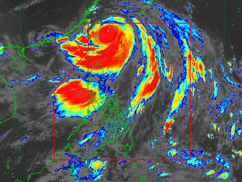
MANILA, Philippines — Typhoon Carina has further intensified as it continues to move northward toward Taiwan, state weather agency PAGASA reported on Wednesday.
In its 11 a.m. bulletin, PAGASA reported that Carina was spotted 345 kilometers north-northeast of Itbayat, Batanes.
Carina is carrying maximum sustained winds of 165 kilometers per hour, with gusts reaching up to 205 kph. Its central pressure stands at 940 hPa.
The typhoon is moving northwestward at a speed of 25 kph.
The following areas are under tropical cyclone wind signals:
Signal No. 2
- Batanes
Signal No. 1
- Babuyan Islands
- the northern portion of mainland Cagayan (Claveria, Santa Praxedes, Sanchez-Mira, Pamplona, Abulug, Ballesteros, Aparri, Camalaniugan, Buguey, Santa Teresita, Santa Ana, Gonzaga)
- the northern portion of Ilocos Norte (Burgos, Bangui, Pagudpud, Dumalneg, Adams)
Heavy rainfall
Residents of Batanes and the Babuyan Islands should prepare for 50-100 mm of rainfall on Wednesday, with heavier amounts expected in elevated or mountainous areas.
PAGASA warned that these conditions could lead to flooding and rain-induced landslides, particularly in areas already susceptible to these hazards.
The enhanced southwest monsoon, fueled by Carina, will bring moderate to intense rainfall over western Luzon until Friday.
Severe winds
The southwest monsoon, enhanced by Carina, will also affect the following regions:
- Ilocos Region, Zambales, Bataan, Abra, Benguet and Occidental Mindoro: Monsoon rains with potential flooding and landslides.
- Metro Manila and nearby provinces: Occasional rains with potential flash floods or landslides.
- Western Visayas and Negros Island Region: Cloudy skies with scattered rains and thunderstorms, with possible flash floods or landslides.
- Rest of the country: Partly cloudy to cloudy skies with isolated showers or thunderstorms, with potential flash floods or landslides during severe weather.
Track outlook
Typhoon Carina is forecast to make landfall over northern Taiwan later, either in the afternoon or early evening.
It is expected to exit the Philippine Area of Responsibility (PAR) on Wednesday night or early Thursday morning.


- Latest
- Trending