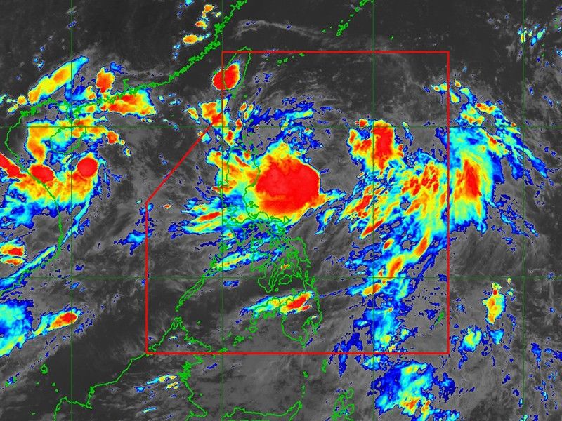
‘Carina’ keeps strength as it moves slowly over Philippine Sea

MANILA, Philippines — Tropical Storm Carina (international name: Gaemi) continued to maintain its strength while slowing its movement over the Philippine Sea on Sunday, according to the state weather bureau PAGASA.
In its 5 p.m. bulletin, PAGASA said that the tropical storm was located 365 kilometers east northeast of Casiguran, Aurora with maximum winds of 85 kilometers per hour (kph) and gusts up to 115 kph.
The state weather bureau said that Carina’s movement is “almost stationary.”
The tropical storm is expected to move generally north northwest to northward from Sunday until Tuesday (July 23) while remaining far from the Philippine landmass.
It is forecasted to exit the Philippine Area of Responsibility (PAR) on Wednesday evening or early Thursday morning, moving near the Ryukyu Islands.
Once outside the PAR, Carina will turn generally northwestward on Thursday over the East China Sea.
Despite Carina's maintained intensity, no wind signal has been issued at this time.
Meanwhile, the southwest monsoon, locally known as habagat, is expected to bring moderate to intense rainfall in parts of the western portion of Luzon.
The state weather bureau advised residents in areas highly susceptible to hazards to follow evacuation orders and other instructions from local officials.
Within the next 24 hours, Carina and the intensified southwest monsoon will also cause moderate sea conditions along the northern seaboard of northern Luzon, the western seaboards of central and southern Luzon and the eastern seaboard of the country.
Mariners operating motorbancas and similarly-sized vessels are urged to take precautionary measures while at sea and, if possible, avoid navigating in these conditions.
- Latest
- Trending


