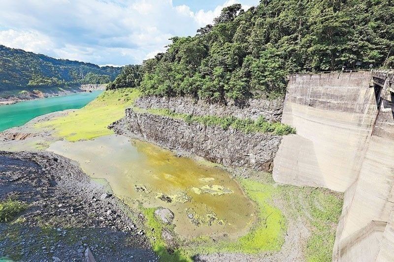
Water levels in Luzon dams below normal

MANILA, Philippines — The water levels of eight dams in Luzon continued to drop amid the impact of the El Niño phenomenon, the latest monitoring of the hydro meteorological division of the Philippine Atmospheric, Geophysical and Astronomical Services Administration (PAGASA) showed.
As of 6 a.m. yesterday, the water level of Angat Dam had dropped by 0.23 meters after it reached 203.25 meters from the previous level of 203.48 meters. This is 8.75 meters below the normal high water level of 212 meters.
But even with the decrease, Angat Dam is still 23.25 meters above its minimum water level of 180 meters. The dam supplies more than 90 percent of Metro Manila’s potable water needs and provides for the irrigation needs of 25,000 hectares of farmlands in Bulacan and Pampanga provinces.
The hydro meteorological division monitoring report also shows a decline in the water elevations of seven other Luzon dams.
The La Mesa Dam in Quezon City reached 76.95 meters or 0.15 meters less compared to its previous level of 77.10 meters. In Benguet province, the Ambuklao Dam is at 747.74 meters, or 0.07 meters less compared to its previous level of 747.81 meters, while its Binga Dam in Benguet is at 570.67 meters or 0.24 meters less compared to its previous level of 570.91 meters.
The San Roque Dam in Pangasinan province is at 239.02 meters, or 0.29 meters less compared to its previous level of 239.31 meters.
Pantabangan Dam in Nueva Ecija also dropped to 182.66 meters or 0.34 meters less compared to its previous level of 183 meters. Isabela province’s Magat Dam is at 172.12 meters, or 0.25 meters less compared to its previous level of 172.37 meters. The Caliraya Dam in Laguna is at 286.20 meters, or 0.04 meters less compared to its previous level of 286.24 meters.
PAGASA said the El Niño has started to weaken and may return to neutral conditions starting next month and lasting until June, when the La Niña phenomenon develops.
Its model forecasts suggest an increasing probability of the La Niña to develop in June until August.
“La Niña is characterized by unusually cooler than average sea surface temperatures in the central and eastern equatorial Pacific,” PAGASA said. It added that a pre-developing La Niña, historically, is characterized by below-normal rainfall.
“Therefore, the possibility of a slight delay in the onset of the rainy season is likely with the combined effects of the ongoing El Niño,” PAGASA said.
Heat index to intensify
The heat index is expected to intensify in April with the end of the southeast monsoon or amihan and will be further aggravated by the peak of El Niño, according to PAGASA.
“At present, we are still experiencing the peak of El Niño where there is a significant reduction in the rainfall in different areas and these (areas) will further increase in April,” PAGASA Climatology and Agrometeorology Division officer-in-charge Anna Lisa Solis said in a radio interview.
Areas affected by the drought will also increase to 40 provinces next month compared to the current 24 provinces, she added.
Aside from the 40 provinces, at least 25 areas will be under dry spell, she noted.
The southeast monsoon continues to bring cold temperatures in many areas.
“After this, once PAGASA officially declares the termination of amihan, we should expect high temperatures,” Solis said.
Based on PAGASA’s projection, General Santos City could experience a heat index of 42 degrees Celsius on Tuesday.
- Latest
- Trending


