'Hanna' further intensifies as strong winds batter Batanes
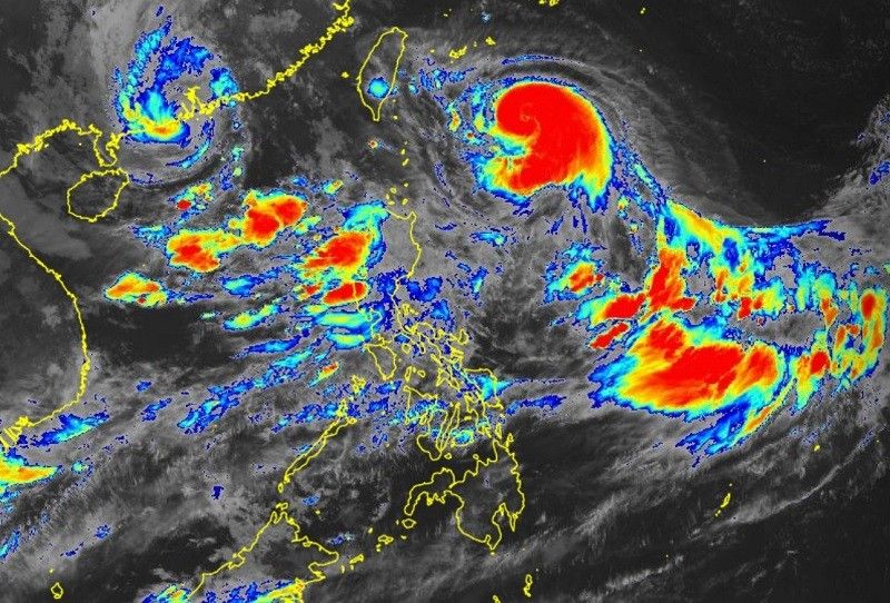
MANILA, Philippines (Updated 12:15 p.m.) — Typhoon Hanna has slightly intensified as it accelerated west northwestward towards the sea east of Taiwan while the tropical cyclone threatened Batanes with strong winds and "minimal to minor" threat to life and property, PAGASA reported on Saturday.
The tropical cyclone's eye was spotted 455 kilometers east northeast of Itbayatt, Batanes at around 10 a.m., according to the latest forecast of PAGASA on Saturday.
- Maximum sustained winds: 130 kilometers per hour near the center
- Gustiness: up to 160 kilometers per hour
- Movement: west northwestward
- Speed: 15 kph
"Hanna is forecast to move west northwestward or westward while intensifying until it makes landfall along the east coast of southern Taiwan on late Sunday," said the state weather bureau.
"Considerable weakening is expected as a result of Hanna crossing the rugged landmass of Taiwan. On the forecast track, Hanna will exit the Philippine Area of Responsibility and emerge over the Taiwan Strait around Monday morning or afternoon."
Tropical Cyclone Warning Signal (TCWS) No. 1 is still hoisted over Batanes.
The TCWS in effect threatens the area with strong winds ranging from 39-61 kph in the next 36 hours, posing minimal to minor threat to life and property.
"Hanna" is seen to dump around 50-100 millimeters of rain in Batanes on Sunday.
"Forecast rainfall are generally higher in elevated or mountainous areas," PAGASA said.
"Under these conditions, flooding and rain-induced landslides are expected especially in areas that are highly or very highly susceptible to these hazards as identified in hazard maps and in localities that experienced considerable amounts of rainfall for the past several days."
Southwest monsoon intensified by 3 cyclones
The southwest moonsoon currently enhanced by Hanna and two other tropical cyclones outside the Philippine area of responsibility ("Saola" and "Kirogi") will bring occasional to monsoon rains over the western portion of Luzon in the next three days.
The enhanced southwest monsoon will bring gusty conditions over the following areas on Saturday and Sunday not under Signal No. 1, especially those in mountainous and coastal areas:
- Batanes
- Babuyan Islands
- Ilocos Region
- Cordillera Administrative Region
- Nueva Vizcaya
- Zambales
- Pampanga
- Bataan
- Aurora
- Bulacan
- Metro Manila
- CALABARZON
- MIMAROPA
- Bicol Region
- Western Visayas
- northern portion of Eastern Visayas


- Latest
- Trending