'Haikui' approaches Philippines as 'Goring' exits PAR
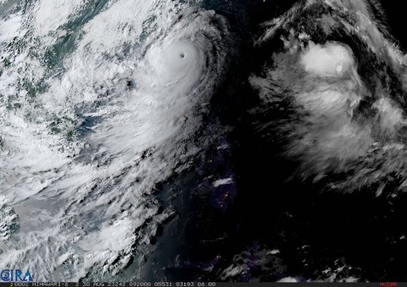
MANILA, Philippines — A cyclone will enter the Philippine Area of Responsibility Wednesday evening, coinciding with the exit of Super Typhoon Goring (international name: Saola), which threatened Northern Luzon with heavy rain and strong winds.
Severe Tropical Storm Haikui was last spotted 1,380 kilometers to the east of Extreme Northern Luzon with peak winds of 100 km per hour near the center and gusts of up to 125 kph, PAGASA weather specialist Aldczar Aurelio said Wednesday afternoon.
Once Haikui enters the country’s monitoring area for cyclones, it will be called “Hanna.”
According to Aurelio, the cyclone will cross the “right corner” of the PAR region. Because of its distance from the landmass, it is not expected to have a direct effect on the country.
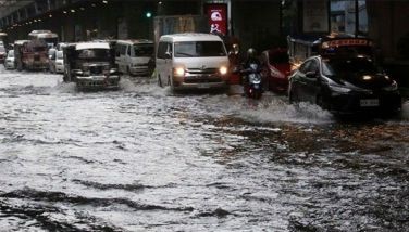
It, however, may enhance the southwest monsoon, which will cause occasional or monsoon rains to persist over the western portion of Luzon and Visayas.
Goring to exit PAR
Meanwhile, Goring was last seen 185 km west of Itbayat in Batanes, and approaching the northwestern boundary of PAR. It is expected to exit PAR tonight or Thursday morning.
The cyclone maintained its peak winds of 195 kph near the center and gusts of up to 240 kph.
PAGASA housed Wind Signal No. 1 over the following areas:
- Batanes
- Babuyan Islands
- Ilocos Norte
- Northern portion of Apayao (Luna, Santa Marcela, Calanasan)
- Northwestern portion of Cagayan (Pamplona, Claveria, Ballesteros, Abulug, Sanchez-Mira, Santa Praxedes)
Areas under Signal No. 1 may experience possible minimal to minor impacts from strong winds.
Up to 200 millimeters or around eight inches of rain is forecast to fall along Batanes, Babuyan Islands, Ilocos Norte, the northern portion of Apayao, and the extreme northwestern portion of mainland Cagayan.
Meanwhile, residents of Ilocos Sur, Abra, the northwestern portion of mainland Cagayan, and the rest of Apayao may have 50 to 100 mm of accumulated rainfall.
The southwest monsoon enhanced by Goring will continue to bring occasional or monsoon rains and gusty conditions over other parts of the country.
The state weather bureau also warned there is “a moderate to high risk of storm surge which may cause flooding in the low-lying and exposed coastal areas of Batanes and the northern and western portions of Babuyan Islands.”
One person was missing, and close to 50,000 people were forced to flee their homes due to Goring and the enhanced southwest monsoon, the National Disaster Risk Reduction and Management Council said Wednesday. — Gaea Katreena Cabico


- Latest
- Trending