More areas in Isabela under Signal No. 3 due to Super Typhoon Goring
MANILA, Philippines (Update 1: 2:52 p.m.) — More areas in Isabela were placed under Signal No. 3 as Super Typhoon Goring (international name: Saola) maintained its strength, state weather bureau PAGASA said Sunday.
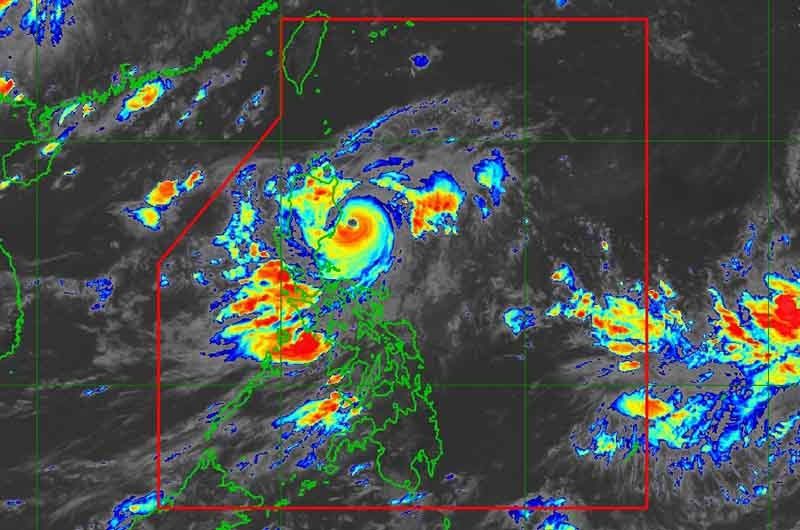
Goring was last seen 95 kilometers east northeast of Casiguran in Aurora, keeping its peak winds of 185 kph near the center and gusts of up to 230 kph. It was heading south off Luzon’s east coast slowly.
PAGASA said Goring may remain a super typhoon until it makes landfall over southern Taiwan on Wednesday or Thursday.
The following areas were placed under Tropical Cyclone Wind Signals:
Signal No. 3
- Eastern portion of Isabela (Divilacan, Palanan, Dinapigue, Ilagan City, San Mariano)
Storm-force winds may cause moderate to significant impacts in these areas.
Signal No. 2
- Eastern portion of mainland Cagayan (Peñablanca, Baggao, Gattaran, Lal-Lo, Gonzaga, Santa Teresita, Buguey, Santa Ana, Enrile, Tuguegarao City)
- Northern and central portion of Isabela (Maconacon, Cabagan, Tumauini, San Pablo, Benito Soliven, San Guillermo, Jones, Echague, San Agustin, Angadanan, City of Cauayan, Naguilian, Gamu, Santa Maria, Santo Tomas, Delfin Albano, Quirino, Burgos, Reina Mercedes, Alicia, Luna, Quezon, Mallig, Roxas, San Manuel, Aurora, Cabatuan, San Mateo, San Isidro)
- Extreme northern portion of Aurora (Casiguran, Dinalungan, Dilasag)
- Eastern portion of Quirino (Maddela)
Minor to moderate impacts from gale-force winds are possible in these areas.
Signal No. 1
- Batanes
- Rest of Cagayan including Babuyan Islands
- Rest of Aurora
- Rest of Quirino
- Rest of Isabela
- Apayao
- Nueva Vizcaya
- Ifugao
- Mountain Province
- Kalinga
- Abra
- Eastern portion of Ilocos Norte (Pagudpud, Adams, Vintar, Carasi, Nueva Era, Banna, Marcos, Dingras, Solsona, Piddig, Dumalneg, Bangui)
- Pollilo Islands
- Eastern portion of Benguet (Bokod, Buguias, Kabayan, Mankayan)
- Eastern portion of Nueva Ecija (Carranglan, Pantabangan, Bongabon, Gabaldon, Laur, Rizal)
- Calaguas Islands
Minimal to minor impacts from strong winds are also possible within any of the areas under Signal No. 1.
What to expect
Up to 200 millimeters or nearly eight inches of rain is forecast to fall along the extreme eastern portion of Isabela and northern portion of Aurora until Monday afternoon, PAGASA said.
The super typhoon will dump an accumulated rainfall of 100 to 200 mm over the eastern portions of Cagayan and Isabela, and around 50 to 100 mm of rain over Ilocos region, Apayao, Abra, Benguet, the rest of Aurora, the eastern portion of Nueva Vizcaya, and the rest of mainland Cagayan and Isabela.
The weather agency warned that floods and landslides may occur in areas that are exposed to these hazards and in localities that experienced significant rainfall for the past few days.
Goring will also enhance the southwest monsoon, which will bring occasional or monsoon rains over the western portions of Central Luzon, Southern Luzon, and Visayas over the next three days.
The enhanced southwest monsoon will continue to bring gusty conditions over the following areas that are not under any wind signal: Bataan, Metro Manila, Calabarzon, Mimaropa, Bicol region, Visayas, Dinagat Islands, and Camiguin.
PAGASA also warned that the condition of the northern and eastern coastal waters of Luzon is “hazardous.”
An average of 20 cyclones enter or develop within PAR every year. Scientists have warned that storms are becoming more powerful and destructive as the world becomes warmer because of climate change.
Goring will begin its loop over the Philippine Sea east of Cagayan-Isabela area before heading north to Taiwan.
“It is likely that Goring will emerge over the Taiwan Strait and exit the PAR region on Friday as a severe tropical storm or a typhoon in its lowest limit,” PAGASA said.
Forecast position
- August 27, 2023 11:00 PM - 155 km east of Casiguran, Aurora
- August 28, 2023 11:00 AM - 270 km east northeast of Casiguran, Aurora
- August 28, 2023 11:00 PM - 345 km east of Tuguegarao City, Cagayan
- August 29, 2023 11:00 AM - 330 km east of Aparri, Cagayan
- August 29, 2023 11:00 PM - 175 km east southeast of Basco, Batanes
- August 30, 2023 11:00 AM - Over the coastal waters of Itbayat, Batanes
- August 31, 2023 11:00 AM - 320 km northwest of Itbayat, Batanes
- September 1, 2023 11:00 AM - 520 km northwest of Itbayat, Batanes (outside PAR)
— Gaea Katreena Cabico


- Latest
- Trending