Signal No. 3 up as Goring gains strength

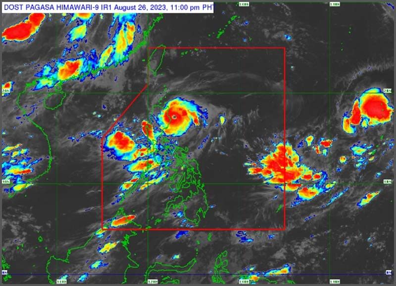
MANILA, Philippines — Typhoon Goring could further intensify into a super typhoon today as tropical cyclone wind Signal (TCWS) No. 3 has been hoisted over parts of Luzon.
The Philippine Atmospheric, Geophysical and Astronomical Services Administration (PAGASA) said that TCWS No. 3 or storm-force winds could be expected over the northeastern portion of Cagayan and the extreme eastern portion of Isabela.
TCWS No. 2 signifying gale-force winds was raised over the eastern portion of Isabela and Cagayan, as well as the northern portion of Aurora province.
Meanwhile, Signal No. 1 was raised over Batanes, the rest of Cagayan including Babuyan Islands, northern and central portion of Aurora, Quirino, the rest of Isabela, Apayao, Nueva Vizcaya, Ifugao, Mountain Province, Kalinga, Abra, eastern portion of Ilocos Norte, Pollilo Islands, eastern portion of Benguet, the eastern portion of Nueva Ecija and Calaguas islands.
Heavy rainfall of around 100-200 millimeters (mm) is forecast over the eastern portion of mainland Cagayan and Isabela from today to tomorrow afternoon.
PAGASA said 50-100 mm of rain is expected over Babuyan Islands, the rest of mainland Cagayan and Isabela, Cordillera Administrative Region, Ilocos Region, Aurora and northern Quezon including Polilio Islands.
State weather forecasters warned that rainfall will be generally higher in elevated or mountainous areas and warned that flooding and rain-induced landslides are possible.
Goring will also enhance the southwest monsoon that is affecting Central and Southern Luzon, the Visayas and Mindanao.
The monsoon will bring occasional rains over Zambales, Bataan and Occidental Mindoro.
Scattered rainshowers are forecast over Metro Manila, CALABARZON, the rest of MIMAROPA, the rest of Central Luzon and Western Visayas.
Goring intensified into a typhoon yesterday and was carrying 155 kph winds near the center and gustiness of up to 190 kph. It was monitored 145 km east of Tugeagarao as of 4 p.m. and was moving southward at 10 kph.
The typhoon is expected to move generally southward before turning northeastward on Monday.
Goring will exit its looping path and move towards the sea east of Taiwan while moving at a consistent pace on Tuesday.
Meanwhile, the Philippine Red Cross (PRC) has mobilized its volunteers and assets for relief operations in areas that will be affected by Typhoon Goring.
PRC chairman Richard Gordon said yesterday that rescue and relief assets such as food trucks, water tankers and ambulances as well as volunteers are ready to move in several regions in Northern Luzon where the typhoon’s strength will be felt.
The PRC also pre-positioned its generators and other rescue equipment in vulnerable areas and mobilized its payloaders to clear roads of landslides, fallen trees and other debris.
“Northern Luzon is still reeling from the impacts of Egay and Falcon. Landslides can be expected to occur in this region as it experienced massive amounts of rain during the past weeks,” Gordon said in a statement. – Emmanuel Tupas
- Latest
- Trending


