'Goring' now a severe tropical storm, may become super typhoon
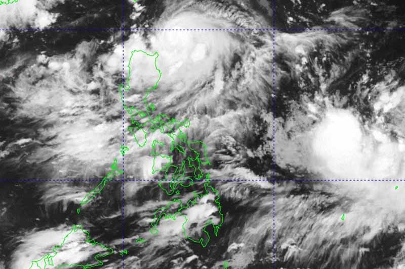
MANILA, Philippines — Cyclone Goring (international name: Saola) reached severe tropical storm category Friday afternoon, and may become a super typhoon in the next few days, PAGASA said.
Goring’s peak winds increased to 110 kilometers per hour near the center and gusts to 135 kph as it moved slowly over the waters off Cagayan province. It was last seen 260 km east of Calayan town.
According to the state weather bureau, the cyclone is expected to rapidly intensify and reach typhoon category by Saturday.
“Goring is forecast to steadily strengthen and may attain its maximum strength by Monday, potentially becoming a super typhoon,” it said.
PAGASA hoisted Tropical Cyclone Wind Signal No. 1 over the following areas:
- Batanes
- eastern portion of Babuyan Islands (Babuyan Island, Camiguin Island)
- eastern portion of mainland Cagayan (Santa Ana, Gonzaga, Lal-Lo, Gattaran, Baggao, Peñablanca, Santa Teresita, Buguey, Camalaniugan, Aparri)
- eastern portion of Isabela (Maconacon, Divilacan, Palanan, Dinapigue, San Mariano, San Pablo, Cabagan, Tumauini, Ilagan City)
“Minimal to minor” impacts from strong winds are possible in these areas.
In the case Goring heads west, the weather bureau may hoist higher wind signals.
What to expect
Heavy rain will affect residents of Batanes, Babuyan Islands, and the northeastern portion of mainland Cagayan until Saturday afternoon.
PAGASA warned that flooding and rain-induced landslides may occur, especially in areas that are susceptible to these hazards and in localities that experienced considerable amounts of rainfall in the past few days.
Goring will enhance the southwest monsoon, which will dump occasional rains to the western portions of Central Luzon and Southern Luzon starting Saturday, and to the western portion of Visayas beginning Sunday.
The enhanced southwest monsoon will also bring gusty conditions over areas not under any wind signal. By Saturday, those living in Aurora, Bataan, Metro Manila, Calabarzon, Bicol region, Dinagat Islands and most of Mimaropa and Visayas will experience gusty conditions.
The weather agency warned that sea travel in the coastal waters of Batanes, Babuyan and the northern coast of mainland Cagayan may be risky.
Goring is forecast to move south southwest or south over the waters east of Northern Luzon until Saturday evening, and turn generally south or southeast for the rest of tomorrow through Sunday afternoon.
Then, it will loop northward before turning northwest on Tuesday toward Luzon Strait.
Forecast position
- August 26, 2023 2:00 AM - 220 km east of Calayan, Cagayan
- August 26, 2023 2:00 PM - 190 km east northeast of Tuguegarao City, Cagayan
- August 27, 2023 2:00 AM - 220 km east of Tuguegarao City, Cagayan
- August 27, 2023 2:00 PM - 235 km east northeast of Casiguran, Aurora
- August 28, 2023 2:00 AM - 290 km east northeast of Casiguran, Aurora
- August 28, 2023 2:00 PM - 400 km east of Tuguegarao City, Cagayan
- August 29, 2023 2:00 PM - 245 km east of Basco, Batanes
- August 30, 2023 2:00 PM - 175 km north northeast of Itbayat, Batanes
— Gaea Katreena Cabico


- Latest
- Trending