Tropical Storm Falcon strengthens as typhoon looms

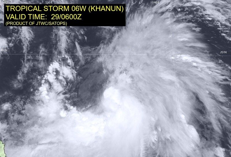
MANILA, Philippines — Tropical Storm Falcon further intensified as it accelerates northward over the Philippine Sea, said the state weather bureau in a statement on Saturday.
The center of the tropical storm was estimated at 1,205 east of central Luzon, as of 4 p.m. today.
- Maximum sustained winds: 75 kilometers per hour near the center
- Gustiness: up to 90 kph
- Direction: northward
- Movement: 20 kph
"Falcon is forecast to steadily intensify within the next 3 days. It is forecast to become a typhoon tomorrow afternoon or evening and reach its peak intensity on late Monday or early Tuesday," said PAGASA.
"This tropical cyclone will remain over the Philippine Sea and far from the Philippine landmass throughout the forecast period."
Falcon is expected to move generally north northwestward on Saturday in the next 36 hours. It will then turn generally northwestward come Monday.
After which, it is projected to exit the PAR region between Monday morning or Tuesday morning.
"The hoisting of wind signal due to Falcon over any locality in the country remains unlikely based on the current forecast scenario," the state weather bureau said.
However, the southwest monsoon currently enhanced by Tropical Storm Egay (now over mainland China) will also be enhanced by Tropical Storm Falcon this weekend.
This will bring occassional monsoon rains over the western portions of Luzon and Visayas in the next three days.
It will also bring gusty conditions over the following areas on Saturday, especially in coastal and mountainous areas exposed to winds: Zambales, Bataan, Palawan, Occidental Mindoro, Romblon, most of CALABARZON, Bicol Region and Western Visayas.
- Latest
- Trending


