'Egay' winds near severe tropical storm strength
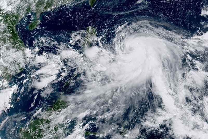
MANILA, Philippines — Tropical Storm Egay (international name: Doksuri) has slightly intensified and is nearing severe tropical storm category, state weather forecasters said Sunday morning.
Egay’s peak winds increased to 85 kilometers per hour near the center, and its gusts increased to 105 kph, PAGASA said in its 5 a.m. bulletin.
According to PAGASA, Egay is forecast to reach typhoon category within 24 hours and may become a super typhoon on Tuesday. Rapid intensification may happen within the next 72 hours due to favorable atmospheric and oceanic conditions.
Egay is expected to remain offshore for most of the forecast period, but PAGASA said that a close approach or landfall in the vicinity of Extreme Northern Luzon is still not ruled out based on the forecast confidence cone.
The tropical storm was last seen 585 km east northeast of Virac in Catanduanes or 705 km east of Daet in Camarines Norte. It was heading west northwest at 10 kph.
What to expect
Egay will cause heavy rain in parts of Bicol on Monday, and in parts of Northern Luzon on Tuesday.
Monday
- 100 to 200 millimeters: Northern portion of Catanduanes
- 50 to 100 mm: Camarines Norte, northern portion of Camarines Sur, and rest of Catanduanes
Tuesday
- 100 to 200 mm: Babuyan Islands and the northern portion of mainland Cagayan
- 50 to 100 mm: Batanes, rest of Cagayan, northern portion of Apayao, Ilocos Norte, Abra, northern portion of Ilocos Sur
PAGASA warned that heavy rain may trigger floods and landslides, especially in areas that are highly or very highly susceptible to these hazards and in localities that experienced considerable amounts of rainfall for the past several days.
Egay may also enhance the southwest monsoon and bring occasional rain in the next three days.
The state weather bureau said that wind signals may be hoisted in some areas in Bicol region and Eastern Visayas today in anticipation of strong breeze to near-gale conditions caused by Egay.
“Current forecast scenario shows that the highest wind signal that may be hoisted will be Wind Signal No. 3 or 4, potentially over Extreme Northern Luzon. However, should a southward shift in the track occur, higher wind signals may be hoisted,” it said.
The cyclone and the southwest monsoon may also bring gusty conditions in Mimaropa, and the northern portions of Zamboanga Peninsula, Northern Mindanao, and Caraga.
Forecast positions
- Jul 23, 2023 2:00 PM - 535 km east northeast of Virac, Catanduanes or 655 km east of Daet, Camarines Norte
- Jul 24, 2023 2:00 AM - 685 km east of Baler, Aurora
- Jul 24, 2023 2:00 PM - 555 km east of Casiguran, Aurora
- Jul 25, 2023 2:00 AM - 485 km east of Tuguegarao City, Cagayan
- Jul 25, 2023 2:00 PM - 360 km east of Aparri, Cagayan
- Jul 26, 2023 2:00 AM - 195 km east of Basco, Batanes
- Jul 27, 2023 2:00 AM - 230 km north northwest of Itbayat, Batanes
- Jul 28, 2023 2:00 AM - 605 km north northwest of Itbayat, Batanes (outside Philippine Area of Responsibility)


- Latest
- Trending