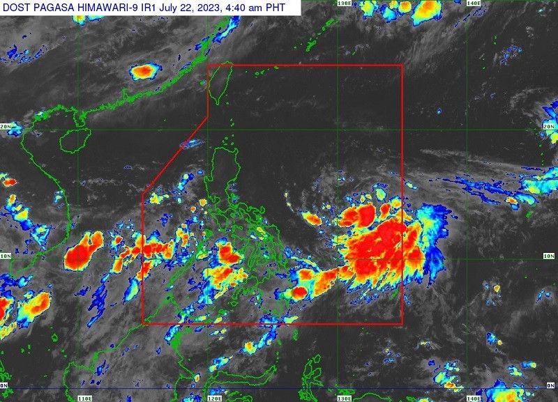
'Egay' to develop into severe tropical storm in 12 hours

MANILA, Philippines — PAGASA reported on Saturday that Tropical Storm Egay has slightly intensified and that wind signals are expected to be hoisted soon in the Bicol Region and Eastern Visayas.
At around 4 p.m. Saturday, state meteorologists estimated the eye of Egay to be around 685 kilometers east of Virac, Catanduanes.
- Maximum sustained winds: 75 kilometers per hours near the center
- Gustiness: 90 kilometers per hour
- Direction: westward
- Movement: 15 kilometers per hour
"In anticipation of the arrival of strong breeze to near-gale conditions associated with Egay, wind signals may be hoisted in some areas in Bicol Region and Eastern Visayas," acccording to a statement by PAGASA.
"Egay is forecast to intensify into a severe tropical storm in the next 12 hours. Through the forecast period, this tropical cyclone will continue to steadily intensify. It may reach peak at super typhoon category on Tuesday or Wednesday while over the Philippine Sea east of Extreme Northern Luzon."
Around 50 to 100 millimeters of accumulated rainfall is seen to be dumped over Catanduanes come Monday in connection with Egay.
The tropical storm may also enhance the southwest monsoon during the weekend and into next week, with occassional rains possible over western Visayas and Occidental Mindoro on Sunday.
Egay is seen tracking generally west northwestward or westward today and Sunday before turning northwestward for the remainder of the forecast period.
Current forecast track indicated that Egay will remain offshore over the Philippine Sea, but the forecast confidence cone showed that a landfall scenario over the northern Luzon is still possible.
Considerable shifts in Egay's track forecast remain possible in succeeding bulletins.
- Latest
- Trending


