'Dodong' to intensify into tropical storm before it exists PAR

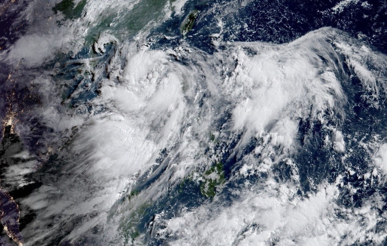
MANILA, Philippines — Tropical Depression Dodong maintains its strength over the West Philippine Sea west of Ilocos Region while the enhanced southwest monsoon continues to bring significant amounts of rains within the next three days, state weather bureau PAGASA said.
The center of Dodong was last observed at around 270 kilometers west of Sinait, Ilocos Sur, according to a forecast of PAGASA released Saturday morning.
- Maximum sustained winds: 55 kilometers per hour near the center
- Gustiness: up to 70 kilometers per hour
- Direction: westward
- Movement: 20 kilometers per hour
All tropical cyclone wind signals have been lifted by the state weather bureau. However, 50-100 millimeters of rain are seen to be dumped in La Union and Pangasinan.
"Under these conditions, flooding and rain-induced landslides are possible, especially in areas that are highly or very highly susceptible to these hazard as identified in hazard maps and in localities that experienced considerable amounts of rainfall for the past several days," PAGASA said.
The enhanced southwest monsoon may still bring gusty conditions over the following areas on Saturday, especially those in coastal and upland/mountainous areas exposed to winds:
- Ilocos Region
- Cordillera Administrative Region
- Batanes
- eastern portion of Isabela
- Quirino
- Nueva Vizcaya
- Zambales
- Bataan
- Bulacan
- Pampanga
- Aurora
- Metro Manila
- CALABARZON
- MIMAROPA
- Bicol Region
- Western Visayas
"Dodong is forecast to move generally northwestward today before turning west northwestward for the remainder of the forecast period. It may exit the Philippine Area of Responsibility (PAR) between this afternoon and tomorrow early morning," said PAGASA.
"Dodong is forecast to intensify while over the West Philippine Sea. It may reach tropical storm category today near the northwestern limit of the PAR region and may peak at typhoon category on Monday," it added.
- Latest
- Trending


