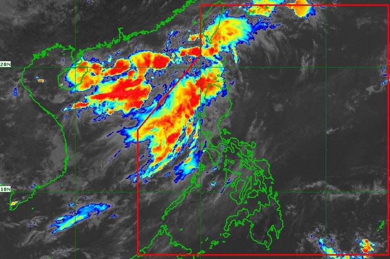
‘Chedeng’ out of PAR, but rains to persist over some areas

MANILA, Philippines — Severe Tropical Storm “Chedeng” (Guchol) exited the Philippine Area of Responsibility late Sunday night, but rains may continue over the western portions of the country due to the southwest monsoon or habagat, state weather service PAGASA said.
Chedeng was last spotted 1,550 kilometers east northeast of extreme northern Luzon and is heading towards Japan, but may dissolve in the coming days, PAGASA weather specialist Obet Badrina said.
Still, the southwest monsoon enhanced by Chedeng and a possible frontal system north of extreme northern Luzon is forecast to bring rains over some areas in western Luzon, while the rest of the country may experience isolated rainshowers and thunderstorms.
PAGASA forecasts that habagat may dump 50 to 100 millimeters of rain over Batanes, Babuyan Islands, Ilocos region, Zambales and Bataan from Monday until Tuesday. The state weather service says Batanes, Babuyan Islands and Ilocos Norte may experience the same conditions until Wednesday.
“Under these conditions, flooding and rain-induced landslides are possible, especially in areas that are highly or very highly susceptible to these hazards,” PAGASA warned.
Rains may also persist over Metro Manila, PAGASA says, but the weather may clear up by Tuesday. — Xave Gregorio
- Latest
- Trending


