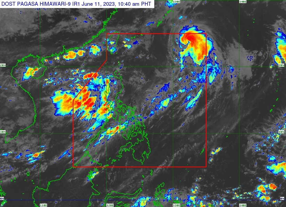
'Chedeng' weakens, forecast to exit PAR tonight

MANILA, Philippines — The state weather bureau expects typhoon Chedeng (international name: Guchol) to already be out of country’s monitoring area by Sunday evening as it was last located near the boundary of the Philippine area of responsibility.
PAGASA’s 11 a.m. advisory showed Chedeng moving further away from the country — now at 1,100 kilometers east northeast of extreme northern Luzon. Winds have slightly slowed down to 120 kilometers per hour near the center and gusts are now at 150 kph.
The typhoon is still moving north-northeastward, faster at 25 kph from 20 kph early Sunday.
“This tropical cyclone will continue to weaken throughout the forecast period under [an] increasingly unfavorable environment. It is forecast to be downgraded into a severe tropical storm within the day,” PAGASA said.
No tropical cyclone wind signal has been hoisted as it is not directly affecting any part of the country.
However, it is still enhancing the southwest monsoon that brings rains over Luzon, particularly its western and extreme northern parts.
Heavy rains of around 100 to 200mm are expected over more areas, including the Ilocos Region, Zambales, Bataan, and Occidental Mindoro on Sunday. Rains of at least 50 to 100mm are expected over Metro Manila, Bulacan, Abra, Benguet, the northern parts of Palawan (including Calamian and Cuyo Islands), and Antique.
As Chedeng moves away from the country, its effect on the monsoon will also decline.
“Gusty conditions will still continue over most of Luzon from Tuesday onwards as the Southwest Monsoon will be enhanced by another weather system,” PAGASA said. The formation of a frontal system — when different air temperatures collide — will affect the monsoon then.
Chedeng’s forecast position
- June 11, Sunday at 8 p.m. - 1,300 km east northeast of extreme northern Luzon (outside PAR)
- June 12, Monday at 8 a.m. - 1,655 km east northeast of extreme northern Luzon (outside PAR)
- Latest
- Trending


