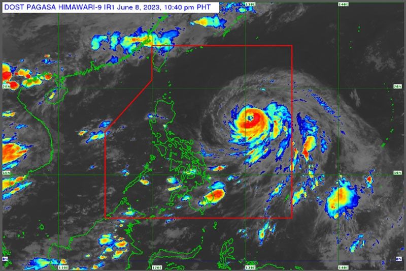
Chedeng intensifies into typhoon

MANILA, Philippines — Tropical cyclone Chedeng intensified into a typhoon yesterday afternoon, but it is still not seen to directly bring heavy rainfall although it may enhance the southwest monsoon or habagat.
The Philippine Atmospheric, Geophysical and Astronomical Services Administration (PAGASA) said that Chedeng (international name Guchol) could further intensify and reach peak intensity by tomorrow.
Chedeng will remain far from the Philippine landmass and is not forecast to make landfall.
Chedeng was monitored 935 kilometers east of Central Luzon as of 4 p.m. yesterday and is moving northwest at 15 km per hour. It was packing maximum sustained winds of 120 kph near the center and gustiness of up to 150 kph.
The hoisting of tropical cyclone wind signals is unlikely, but Chedeng may result in the enhancement of the monsoon.
The timing and intensity of monsoon rains over the country may still change depending on the movement and intensity of Chedeng and its interaction with other weather systems.
The monsoon may bring gusty conditions over parts of Visayas, Palawan, Occidental Mindoro, Surigao del Norte, Dinagat Islands and Camiguin today.
The southwest monsoon is bringing scattered rainshowers over Palawan.
Metro Manila and the rest of the country may expect isolated rainshowers due to the monsoon and localized thunderstorms.
PAGASA warned of possible flash floods or landslides during heavy rains.
- Latest
- Trending


