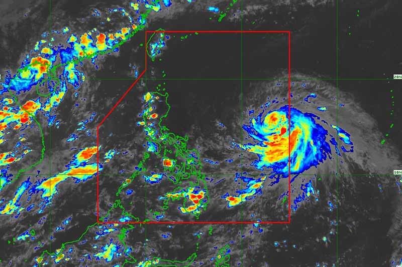
Chedeng slightly strengthens, but still far from land

MANILA, Philippines — Tropical Storm Chedeng (Guchol) intensified anew while moving slowly over the Philippine Sea, state weather bureau PAGASA said Wednesday afternoon.
Chedeng was spotted 1,150 kilometers east of southeastern Luzon, with peak winds of 85 km per hour near the center and gusts of up to 105 kph. It was moving west northwest slowly.
What to expect
According to PAGASA, Chedeng will remain far from the Philippine landmass throughout the forecast period.
Because of this, the tropical storm is not expected to bring heavy rain in the next three to five days. The hoisting of wind signals in anticipation of Chedeng’s severe winds is also unlikely.
Chedeng may enhance the southwest monsoon (habagat). But PAGASA noted the timing and intensity of monsoon rains as well as the likelihood of intermittent gusts may still change.
“We are on the lookout for the southwest monsoon, which will bring rain and strong winds depending on Chedeng's behavior,” weather specialist Aldczar Aurelio said.
The storm is also unlikely to cause rough sea conditions in the next 24 hours.
Chedeng may intensify in the next three to four days, and may become a severe tropical storm Wednesday evening or Thursday. It may reach typhoon category by late Thursday or Friday.
Forecast position
- June 7, 2023 2:00 PM - 1,270 km east of Southeastern Luzon
- June 8, 2023 2:00 AM - 1,145 km east of Central Luzon
- June 8, 2023 2:00 PM - 970 km east of Central Luzon
- June 9, 2023 2:00 AM - 885 km east of Central Luzon
- June 9, 2023 2:00 PM - 885 km east of Northern Luzon
- June 10, 2023 2:00 AM - 845 km east of Northern Luzon
- June 11, 2023 2:00 AM - 840 km east of Extreme Northern Luzon
- June 12, 2023 2:00 AM - 1,090 km east northeast of Extreme Northern Luzon
— Gaea Katreena Cabico
- Latest
- Trending


