Cyclone to develop into super typhoon in 24 hours

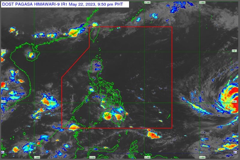
MANILA, Philippines — The tropical cyclone outside the Philippine area of responsibility (PAR) is expected to develop into a super typhoon within the next 24 hours, the Philippine Atmospheric, Geophysical and Astronomical Services Administration (PAGASA) said yesterday.
PAGASA weather forecaster Ana Clauren-Jorda said the weather disturbance – with international name Mawar – was located at 2,330 kilometers east of Mindanao.
“We are continuously monitoring the typhoon outside of our PAR as in the next 24 hours to 48 hours, it is possible that it will develop into a super typhoon,” Clauren-Jorda said.
Typhoon Mawar has maximum sustained winds of 130 kilometers per hour near the center and gustiness of up to 160 kph as it is moving west northwestward at 15 kph.
“We don’t see that it will have a landfall scenario in any part of the country but we still advise the public to prepare for possible strong rains,” Clauren-Jorda said.
She said the tropical cyclone will enhance the southwest monsoon.
“Rains will be expected in the western part of the country brought by the enhanced southwest monsoon,” Clauren-Jorda said.
She added that the country should expect stormy weather over the weekend.
“Later part of this week, we should be prepared as we can experience rains over the weekend, especially the western section of the country and flood prone areas,” Clauren-Jorda said.
The weather disturbance is expected to enter the country by Friday or Saturday and it will be named Betty.
PAGASA expects at least one typhoon in May; two typhoons in June; two to three typhoons in July, August and September.?The state bureau said that a southwesterly windflow is currently affecting the western sections of Southern Luzon, the Visayas and Mindanao.
Related video:
- Latest
- Trending


