PAGASA monitoring storm outside PAR

MANILA, Philippines — The state weather bureau is monitoring a tropical storm outside the Philippine area of responsibility that could possibly turn into a super typhoon this coming week.
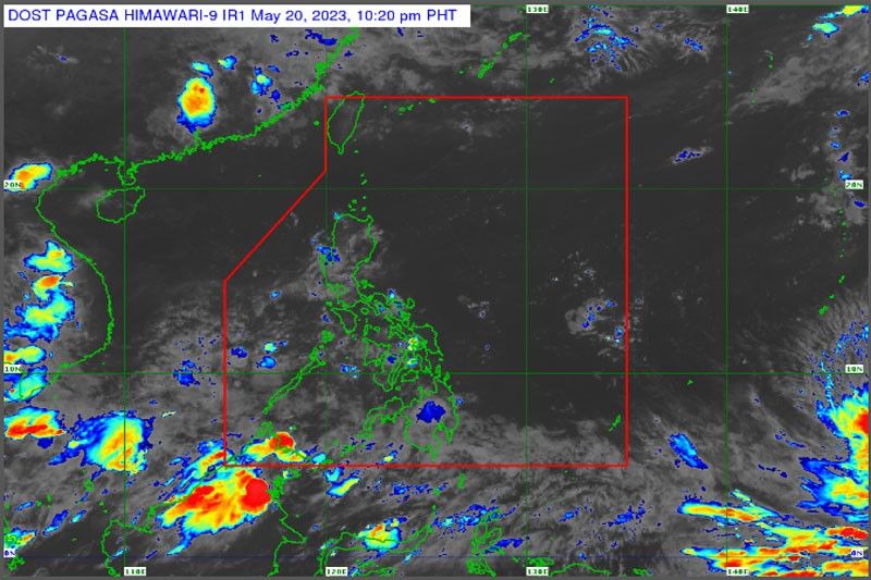
The Philippine Atmospheric, Geophysical and Astronomical Services Administration (PAGASA) said the tropical storm, with international name Mawar, was monitored 2,525 kilometers east of northeastern Mindanao.
The tropical storm, embedded in the intertropical convergence zone (ITCZ), could get stronger as it moves over the Pacific Ocean.
It may develop into a typhoon or a supertyphoon within the next week. PAGASA said the storm is forecast to start moving north and northwestward starting today.
It may enter the boundaries of the Philippine area of responsibility by next weekend and will be given the local name Betty.
It is not expected to make direct landfall, but may strengthen the southeast monsoon by next week.
Mawar currently has no direct effect over the country.
Mawar was carrying maximum sustained winds of 65 kilometers per hour and gustiness of up to 80 kilometers per hour.
Meanwhile, the ITCZ will bring scattered rainshowers over parts of the Philippines today.
PAGASA said cloudy skies with scattered rains and thunderstorms are forecast over Western Visayas, the Zamboanga Peninsula, BARMM and Palawan.
Isolated rains are also expected over Metro Manila and the rest of the country due to the ITCZ and localized thunderstorms.
The bureau warned of possible flash floods or landslides during severe thunderstorms.
- Latest
- Trending


