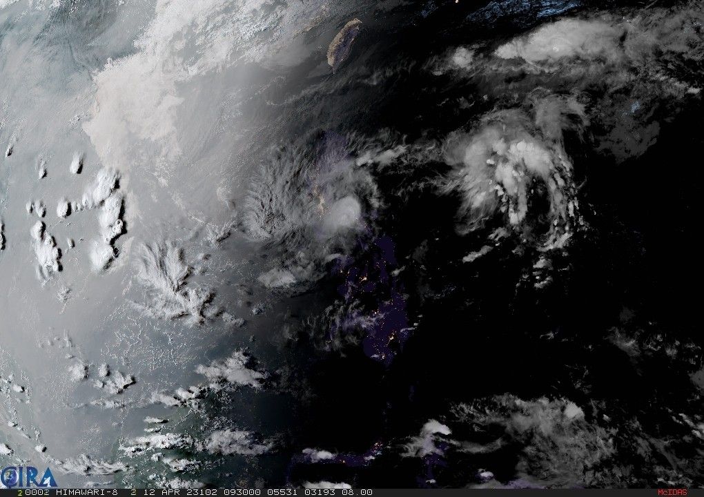
‘Amang’ makes third landfall over Camarines Sur town; 11 areas under Signal No. 1

MANILA, Philippines — Tropical Depression “Amang” made its third landfall Wednesday afternoon over Lagonoy town in Camarines Sur, state weather service PAGASA said in a bulletin issued at 5 p.m.
The country’s first cyclone of the year was last spotted within the vicinity of the town with peak winds of 45 kilometers per hour near the center and gusts of up to 55 kph.
Tropical Cyclone Wind Signal No. 1 was raised in the following areas:
- Catanduanes
- Sorsogon (City of Sorsogon, Pilar, Castilla, Donsol, Prieto Diaz)
- Albay
- Camarines Sur
- Camarines Norte
- Laguna (Cavinti, Lumban, Kalayaan, Paete, Pakil, Pangil, Siniloan, Famy, Santa Maria, Mabitac)
- Aurora
- Quezon (Buenavista, Calauag, Infanta, Lopez, Guinayangan, Plaridel, Quezon, Alabat, Sampaloc, Mauban, General Nakar, Perez, Gumaca, Atimonan, Real, Tagkawayan, San Narciso) including Polillo Islands
- Rizal (Tanay, Pililla, Rodriguez, Baras, City of Antipolo)
- Bulacan (Norzagaray, Doña Remedios Trinidad)
- Nueva Ecija (Gabaldon, Bongabon, Laur, General Tinio)
What to expect
According to state meteorologists, areas under Wind Signal No. 1 may experience strong winds that “may cause minimal to minor impacts to life and property.”
Residents of Camarines Norte, Camarines Sur and Quezon will experience heavy rain until Thursday afternoon.
Heavy rain will also affect Calabarzon, Metro Manila, Tarlac, Pampanga, Bulacan, Camarines Norte, Camarines Sur and the southern portion of Aurora in the next three days.
PAGASA warned that heavy rain may trigger flash floods and landslides.
Moderate to rough seas may be experienced over Southern Luzon (wave height from 1.5 to 3.5 m) and the eastern seaboard of Central Luzon (wave height from 1.5 to 2.8 m). Those with small seacrafts are advised to take precautionary measures when venturing out to sea and, if possible, avoid navigating in these conditions.
Amang is expected to head northwest in the next 12 hours, and is expected to pass over the eastern parts of Camarines Sur, Lamon Bay, and Quezon province, with the possibility of passing near or over Polillo Islands.
“Considering the weak and disorganized nature of this depression, considerable changes in the track forecast of succeeding bulletins are not ruled out,” PAGASA said.
The tropical depression is forecast to weaken into a low pressure area by Thursday, possibly earlier, due to the combined effects of land interaction, dry air intrusion, and increasing vertical wind shear.
Forecast position
- Apr 13, 2023 02:00 AM - Over the coastal waters of Jose Panganiban, Camarines Norte
- Apr 13, 2023 02:00 PM - Over the coastal waters of Panukulan, Quezon
- Apr 14, 2023 02:00 AM - In the vicinity of Carranglan, Nueva Ecija
— Xave Gregorio
- Latest
- Trending


