'Queenie' weakens into LPA; rains still seen in parts of Mindanao

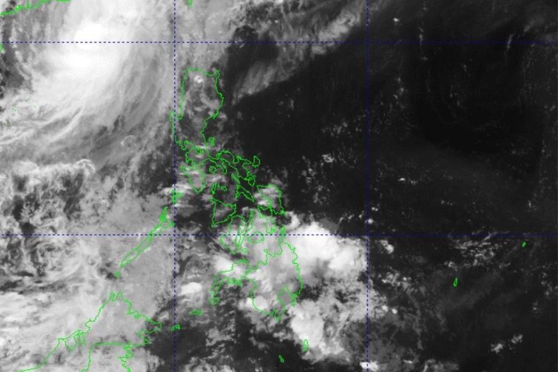
MANILA, Philippines — Cyclone Queenie has weakened into a low pressue area while moving over the Philippine Sea, the state weather bureau said Tuesday afternoon.
In a bulletin issued past 5 p.m., PAGASA said Queenie weakened into a remnant low at 2 p.m. It earlier said that the weakening was expected due to “unfavorable” environmental conditions.
It was last seen 420 kilometers east of Hinatuan in Surigao del Sur.
The remnant low will continue moving northwestward and may dissipate in the next 12 hours.
Despite the development, the weather disturbance may still bring light to moderate with at times heavy rains to Caraga and Davao Oriental. PAGASA warned that flooding and rain-induced landslides are possible, especially in areas that are highly susceptible to these hazards and in localities with significant antecedent rainfall.
Parts of Mindanao are still reeling from the effects of Severe Tropical Storm Paeng (Nalgae), which triggered flash floods and landslides that killed at least 110 people.
Paeng affected over 2.4 million people across the archipelago.
Weather forecasters added that the remnant low is not expected to bring rough seas over the country’s coastal waters.
The Philippines is hit by 20 tropical cyclones annually. Scientists have warned that storms are becoming stronger as the world continues to heat up due to climate change.
- Latest
- Trending


