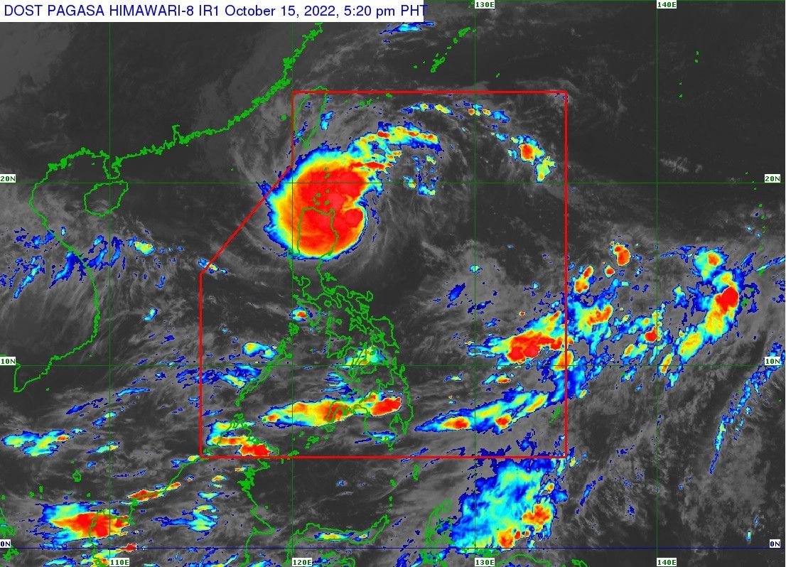
Signal No. 2 up in 5 areas as 'Neneng' becomes a tropical storm

MANILA, Philippines — State weather service PAGASA raised Signal No. 2 on Saturday afternoon over five areas in northern Luzon as Neneng intensified into a tropical storm and continued to threaten Babuyan Islands and Batanes.
Neneng — the 14th tropical cyclone in the country — was last spotted 255 kilometers east southeast of Calayan, Cagayan packing winds of 65 kph near the center and gusts of up to 80 kph.
Signal No. 2 is hoisted over the following areas, which can expect winds between 62 kph and 88 kph in at least 24 hours:
- Batanes
- Cagayan including Babuyan Islands
- Apayao
- Northern portion of Abra (Tineg, Lacub, Lagayan)
- Ilocos Norte
Meanwhile, Signal No. 1 is up in the following areas, which can expect winds between 39 kph to 61 kph or intermittent rains within 36 hours:
- Northern portion of Isabela (Santa Maria, San Pablo, Maconacon, Divilacan, Palanan, Ilagan City, Tumauini, Cabagan, Santo Tomas, Quezon, Delfin Albano, Mallig, Quirino, Gamu, Roxas)
- Kalinga
- Rest of Abra
- Northern portion of Mountain Province (Paracelis, Natonin, Barlig, Sadanga, Bontoc, Sagada, Besao)
- Northern portion of Ilocos Sur (Sinait, Cabugao, San Juan, Magsingal, Santo Domingo, San Ildefonso, San Vicente, Santa Catalina, Bantay, City of Vigan, Santa, Caoayan, Narvacan, Nagbukel, Santa Maria, San Esteban, Santiago, Burgos, Banayoyo, Lidlidda, San Emilio, Quirino, Gregorio del Pilar, Galimuyod, City of Candon, Santa Lucia, Salcedo)
PAGASA says it is “most likely” that the highest wind signal it will raise is Signal No. 3, but is not ruling out the possibility of raising Signal No. 4.
Neneng is forecast to pass very close or make landfall in the vicinity of Babuyan Islands or Batanes on Sunday morning and may strengthen into a severe tropical storm while passing through this area. The tropical cyclone may even intensify into a typhoon by Tuesday.
Batanes and Cagayan including Babuyan Islands can expect heavy to intense with at times torrential rains until Saturday night, while Apayao, Kalinga, Abra, and Ilocos Norte may experience moderate to heavy with at times intense rains.
Light to moderate with at times heavy rains are expected until Saturday night over the northern portion of Isabela and the rest of Ilocos Region and Cordillera Administrative Region.
On Sunday, Batanes, the northern portion of mainland Cagayan, Babuyan Islands, and Ilocos Norte are forecast to experience heavy to intense with at times torrential rains, while Apayao, Kalinga, Abra, Ilocos Sur, and the rest of mainland Cagayan may experience moderate to heavy with at times intense rains.
Light to moderate with at times heavy rains may occur Sunday over the northern portion of Isabela and the rest of Ilocos Region and Cordillera Administrative Region.
PAGASA warns that flooding and rain-induced landslides may happen under these conditions.
Neneng’s trough and the convergence of its circulation with the southwesterly winds may also bring occasional rains over the western portions of Mimaropa and Western Visayas, PAGASA says.
With the surge of northeasterly surface wind flow and Neneng’s approach, moderate to rough seas are expected over the eastern seaboards of Central and Southern Luzon, making sea travel risky for small vessels.
Forecast position
- October 16, 2 a.m. - Over the coastal waters of Camiguin Island, Cagayan
- October 16, 2 p.m. - 125 km West of Calayan, Cagayan
- October 17, 2 a.m. - 320 km West of Calayan, Cagayan (outside PAR)
- October 17, 2 p.m. - 440 km West of Calayan, Cagayan (outside PAR)
- October 18, 2 a.m. - 450 km West of Laoag City, Ilocos Norte (outside PAR)
- October 18, 2 p.m. - 580 km West of Sinait, Ilocos Sur (outside PAR)
- October 19, 2 p.m. - 890 km West of Northern Luzon (outside PAR)
— Xave Gregorio
- Latest
- Trending


