'Maymay' seen to weaken into remnant low as it nears land

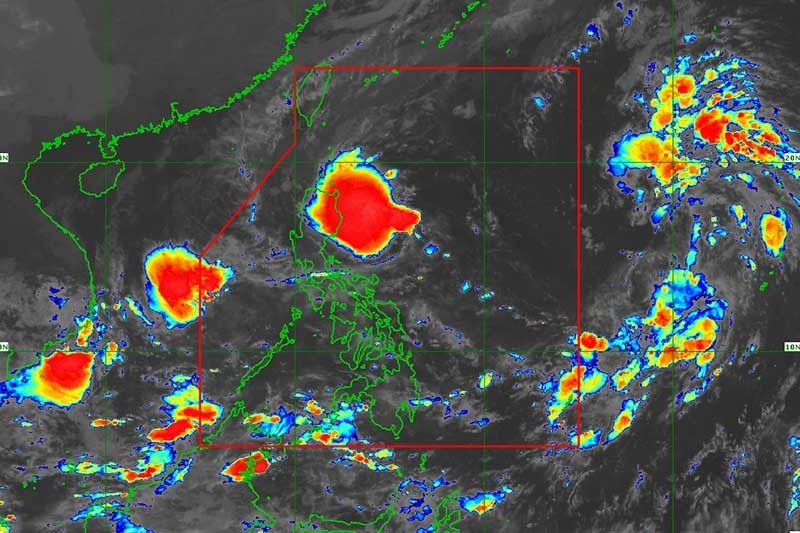
MANILA, Philippines (Updated 12:13 p.m.) —Tropical depression Maymay is forecast to weaken into a remnant low as it approaches Central Luzon, weather forecasters said Wednesday.
Maymay was last spotted 310 kilometers east northeast of Baler or 245 km east of Casiguran in Aurora, moving almost stationary. According to PAGASA, it is expected to move west or west southwest toward the eastern coast of Central Luzon.
The cyclone was packing maximum sustained winds of 45 km an hour and gusts of up to 55 kph.
The following areas remained under Tropical Cyclone Wind Signal No. 1:
- Isabela
- Quirino
- Nueva Vizcaya
- Aurora
- Nueva Ecija
- Extreme northern portion of Quezon (General Nakar, Infanta) including Polillo Islands
What to expect
According to the state weather bureau, moderate to heavy with at times intense rains are expected in Cagayan, northern portion of Isabela, Apayao, Kalinga, Mountain Province and Ifugao.
Light to moderate with at times heavy rains will affect the rest of Cagayan Valley and Cordillera Administrative Region.
Strong winds — strong breeze to near gale strength — may affect any of the areas where TCWS No. 1 is raised.
Occasional gusts reaching strong to gale force strength associated with the enhanced northeasterly surface wind flow and its convergence with Maymay may also be experienced in Batanes, Cagayan (including Babuyan Islands), Cordillera Administrative Region, and Ilocos region.
A marine gale warning remained in effect over the seaboards of Northern and Central Luzon, and the eastern seaboard of Southern Luzon.
The surge of northeasterly surface wind flow may also bring moderate to rough seas (1.5 to 3.5 meters) over the western seaboards of Central and Southern Luzon.
These conditions may be risky for those using small seacrafts.
Maymay’s position
- Oct 12, 2022 8:00 p.m. - 210 km east of Casiguran, Aurora
- Oct 13, 2022 8:00 a.m. - Over the coastal waters of Casiguran, Aurora
- Oct 13, 2022 8:00 p.m. - In the vicinity of Maria, Aurora
Other weather disturbances
PAGASA is also monitoring a tropical depression outside the Philippine Area of Responsibility and a low pressure area west of Occidental Mindoro.
The tropical depression was last seen 1,980 km east of Northern Luzon, with peak winds of 45 kph and gusts of up to 55 kph. It is heading northwest at 20 kph.
In the latest bulletin, PAGASA said the cyclone may enter PAR Thursday morning or afternoon and may reach tropical storm category by Friday.
The agency said there is a “high likelihood” that wind signals will be hoisted over Batanes and several provinces in Northern Luzon.
“The passage of this tropical cyclone over Extreme Northern Luzon may bring heavy rainfall over the area beginning Saturday. Furthermore, the tropical cyclone may also bring rough to very rough seas over the northern and eastern seaboards of Luzon beginning late Friday or Saturday,” it said.
Meanwhile, the LPA was last seen 520 km west of San Jose, Occidental Mindoro. — Gaea Katreena Cabico
- Latest
- Trending


