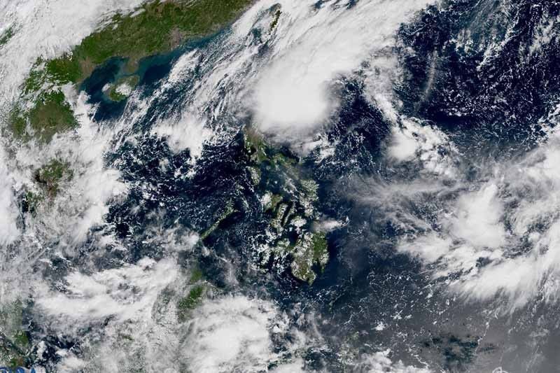
'Maymay' keeps strength; landfall seen on Wednesday

MANILA, Philippines — Tropical Depression Maymay kept its strength while moving over the Philippine Sea, state weather bureau PAGASA said Tuesday.
Maymay — the country’s 13th tropical cyclone this year — was last seen 285 kilometers east of Casiguran, Aurora.
The tropical depression was packing peak winds of 45 kilometers an hour and gusts of up to 55 kph. It was heading southwest slowly.
The weather agency hoisted TCWS No. 1 over the following areas:
- Isabela
- Quirino
- Nueva Vizcaya
- Aurora
- Nueva Ecija
- Extreme northern portion of Quezon (General Nakar, Infanta) including Polillo Islands
Some of these areas were ravaged by Super Typhoon Karding last month.
What to expect
Strong winds — or strong breeze to near gale strength — may be experienced in any of the areas where TCWS No. 1 is currently in effect.
Occasional gusts associated with the enhanced northeasterly surface wind flow and its convergence with Maymay’s circulation are expected in Batanes, Cagayan, including Babuyan Islands, Apayao, and Ilocos Norte in the next 24 hours.
PAGASA said residents of Cagayan, Isabela, Batanes and Apayao will experience moderate to heavy with at times intense rains until Wednesday morning.
Meanwhile, light to moderate with at times heavy rains will affect Aurora, Abra, Kalinga, Mountain Province, and Ilocos Norte.
Weather forecasters issued marine gale warning over the northern seaboards of Northern Luzon, and the eastern seaboard of Central and Southern Luzon.
Moderate to rough seas (1.5 to 3 meters) are also expected over the western seaboard of Central Luzon, which may be risky for those using small sea vessels.
Wednesday landfall
The center of Maymay is expected to make landfall in the vicinity of Aurora or the northern portion of Quezon Wednesday afternoon or evening. Then, it will traverse Central Luzon before emerging over the West Philippine Sea by Thursday morning or afternoon.
The cyclone is expected to maintain its strength prior to its landfall. It may be downgraded to a low pressure area due to frictional effects.
"This tropical cyclone may be downgraded to low pressure area once it emerges over the West Philippine Sea. Weakening to low pressure area while traversing over Central Luzon is not ruled out," PAGASA said.
Weather forecasters are also monitoring a tropical depression outside the Philippine Area of Responsibility.
PAGASA said the cyclone may reach tropical storm category within 72 hours. It is expected to enter the PAR region on Thursday morning.
Maymay’s track
- Oct 11, 2022 8:00 PM - 215 km east of Casiguran, Aurora
- Oct 12, 2022 8:00 AM - 125 km east Southeast of Casiguran, Aurora
- Oct 12, 2022 8:00 PM - Over the coastal waters of Baler, Aurora
- Oct 13, 2022 8:00 AM - Over the coastal waters of Masinloc, Zambales
— Gaea Katreena Cabico
- Latest
- Trending


