'Florita' maintains strength as it crosses Cagayan
MANILA, Philippines (Updated 2:55 p.m.) — Severe Tropical Storm Florita (Ma-on) has maintained its strength as it moves over Cagayan province, state weather bureau PAGASA said Tuesday afternoon.
Florita—the sixth tropical cyclone in the country’s jurisdiction this year—made a landfall in Maconacon, Isabela at 10:30 a.m. Weather forecasters said it was last seen in the vicinity of Alcala-Baggao Road in Alcala town.
It has peak winds of 110 kph near the center and gusts of up to 185 kph. Florita is expected to weaken slightly due to the frictional effects of Northern Luzon’s rugged terrain.
The severe tropical storm is heading west northwest at 20 kph.
PAGASA hoisted wind signals over the following areas in Luzon:
Signal No. 3 (Storm-force winds prevailing or expected within 18 hours)
• Northern portion of Ilocos Norte (Adams, Dumalneg, Bangui, Burgos, Pasuquin, Vintar, Pagudpud, Carasi, Bacarra, Piddig)
• Apayao
• Southern portion of Babuyan Islands (Camiguin Is., Fuga Is., Dalupiri Is.)
• Mainland Cagayan
• Northeastern portion of Isabela (Palanan, Divilacan, Maconacon, San Pablo, Tumauini, Cabagan, Santa Maria, Santo Tomas, Delfin Albano, Ilagan City, San Mariano)
According to PAGASA, winds may cause “moderate to significant threat to life and property.”
Signal No. 2 (Gale-force winds prevailing or expected within 24 hours)|
• Rest of Babuyan Islands
• Rest of Isabela
• Quirino
• Northern and eastern portion of Nueva Vizcaya (Quezon, Diadi, Bagabag, Villaverde, Solano, Kasibu)
• Abra
• Kalinga
• Mountain Province
• Ifugao
• Northern portion of Benguet (Buguias, Bakun, Mankayan, Kibungan)
• Rest of Ilocos Norte
• Ilocos Sur
• Northern portion of Aurora (Dilasag, Casiguran, Dinalungan, Dipaculao)
Winds may cause “minor to moderate threat to life and property.”
Signal No. 1 (Strong winds prevailing or expected within 36 hours)
• Batanes
• Rest of Nueva Vizcaya
• Rest of Benguet
• La Union
• Eastern portion of Pangasinan (Santo Tomas, Villasis, Mapandan, Mangaldan, San Fabian, San Jacinto, Manaoag, City of Urdaneta, Rosales, Balungao, Umingan, San Quintin, Natividad, San Nicolas, Tayug, Santa Maria, Asingan, San Manuel, Binalonan, Sison, Pozorrubio, Laoac, Dagupan City)
• Northeastern portion of Tarlac (San Manuel, Anao)
• Nueva Ecija
• Rest of Aurora
Winds may cause “minimal to minor life threat,” PAGASA said.
According to the National Disaster Risk Reduction and Management Council, 543 individuals or 180 families in Cagayan Valley and the Cordillera Administrative Region have been pre-emptively evacuated.
President Ferdinand Marcos Jr. suspended classes in public schools and government work in Metro Manila, Cavite, Laguna, Rizal, Bulacan, Zambales, and Bataan until Wednesday.
What to expect
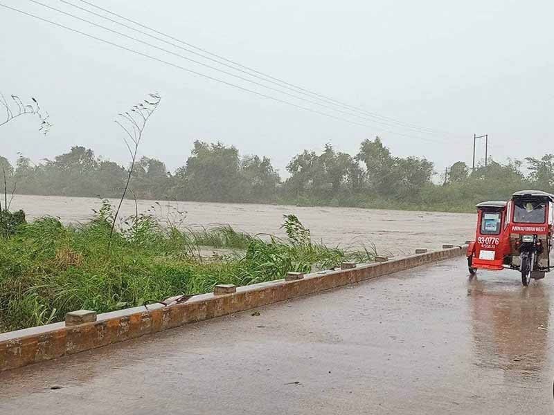
According to PAGASA, heavy to intense with at times torrential rains will affect Cagayan including Babuyan Islands, Isabela, Cordillera Administrative Region, Ilocos region, Zambales, and Bataan this Tuesday.
Residents of the northern portion of Aurora, Tarlac, Pampanga, Bulacan, Metro Manila, Cavite, Rizal, and the rest of Cagayan Valley will experience moderate to heavy with at times intense rains.
Meanwhile, light to moderate with at times heavy rains will prevail over the rest of Central Luzon and the rest of Calabarzon.
The southwest monsoon or habagat will also trigger rains in Western Visayas and Mimaropa.
In the next 24 hours, gusts reaching strong breeze to near gale strength may be experienced in Metro Manila, Zambales, Bataan, Mindoro provinces, Marinduque, Romblon, Northern Samar, Antique, Aklan, Calabarzon, and Bicol region, especially in the coastal and mountainous areas.
PAGASA also said that a gale warning remains in effect over the seaboards of Northern and Central Luzon, most of the seaboards of Southern Luzon, and the western seaboards of Visayas due to Florita and the southwest monsoon.
The cyclone and the southwest monsoon will also bring rough seas (1.2 to 2.8 meters) over the remaining seaboards of Southern Luzon and Visayas.
Florita will continue moving northwest or west northwest and will likely cross the mainland Cagayan and Apayao.
Then, it will emerge over the Babuyan Channel this evening. Florita may leave the Philippine Area of Responsibility Wednesday morning.
Forecast position
• Aug 23, 2022 11:00 PM - 135 km West of Calayan, Cagayan
• Aug 24, 2022 11:00 AM - 445 km West of Basco, Batanes (Outside the PAR)
• Aug 24, 2022 11:00 PM - 665 km West of Basco, Batanes (Outside the PAR)
• Aug 25, 2022 11:00 AM - 48-Hour Forecast 11:00 AM 25 August 2022 22.1 112.8 950 km West of Extreme Northern Luzon or in the vicinity of Guangdong Province, China (Outside the PAR) 95 STS WNW 25
• Aug 25, 2022 11:00 PM - 1,305 km West Northwest of Extreme Northern Luzon or in the vicinity of Guangxi, China (Outside the PAR)
— Gaea Katreena Cabico


- Latest
- Trending